
By Gabe Whisnant
News Editor
0
Share
Newsweek is a Trust Project member
See more of our trusted coverage when you search.Prefer Newsweek on Googleto see more of our trusted coverage when you search.
A winter weather advisory is in effect across parts of the Great Lakes and Upper Midwest as ice and snow threatened to disrupt post-holiday travel following Christmas, forecasters said Thursday.
Why It Matters
The National Weather Service (NWS) said a multi-hazard storm system moving through the region could bring a mix of freezing rain, sleet and snow from Wisconsin and Michigan into parts of northern Illinois, Indiana and Ohio, creating slick roads and hazardous driving conditions through Friday.
Read More on News
What To Know
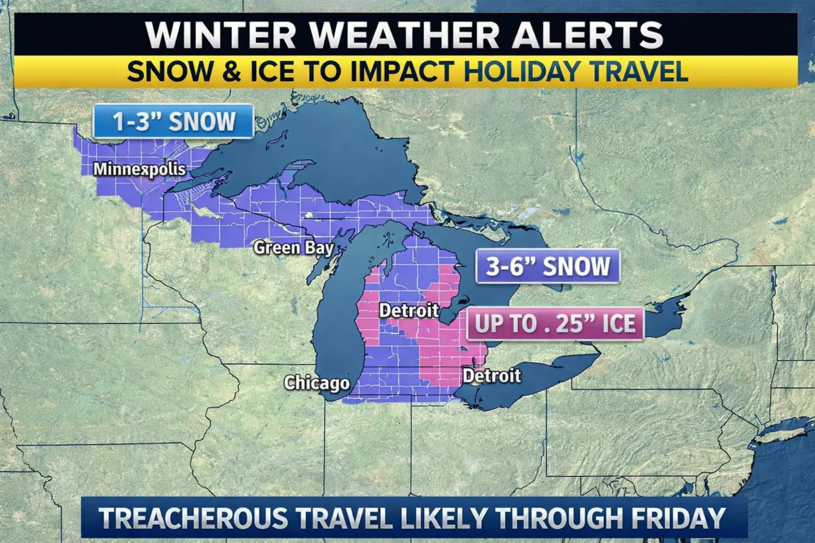
Ice accumulation was expected to be the primary concern in several areas. Forecasters warned that portions of Michigan, northern Ohio and nearby regions could see up to a quarter-inch of ice, enough to make travel dangerous and potentially lead to isolated power outages. Even smaller amounts of ice can significantly increase the risk of crashes and falls.

...
Snowfall totals were forecast to vary widely across the region. Much of the Upper Midwest was expected to receive 1 to 3 inches of snow, while areas closer to the eastern Great Lakes could see 3 to 6 inches, with locally higher amounts possible where bands of heavier snow develop. Some lake-enhanced snowfall was also possible as colder air moved in behind the system.
The Weather Prediction Center said the combination of snow and ice could lead to travel delays on major highways and at airports, particularly during peak return travel following the Christmas holiday.
Transportation agencies across the region said crews were pre-treating roads, but warned that rapidly changing conditions could still make travel hazardous. Drivers were urged to slow down, allow extra travel time and carry emergency supplies.
Forecasters said additional advisories or warnings could be issued as conditions evolve, with weather expected to improve in many areas by the weekend.
Meanwhile, a winter storm is predicted to hammer the Northeast's mid-Atlantic states on Friday with up to 10 inches of snow in some areas as it mainly hits parts of Pennsylvania, New Jersey and New York, according to the National Weather Service (NWS).
Most areas will expect between 4 and 8 inches of snow, but 10 inches will fall in some areas, meteorologists warn. The rest of the area will likely see less, from 2 to 5 inches as well as 8 inches in isolated areas.
Updates: 12/25/25, 8:55 p.m. ET: This article was updated with new information and remarks.
View 0 Comments
Submit Correction
View Editorial & AI Guidelines