
...

By Anna Skinner
Associate News Editor
0
Share
Newsweek is a Trust Project member
See more of our trusted coverage when you search.Prefer Newsweek on Googleto see more of our trusted coverage when you search.
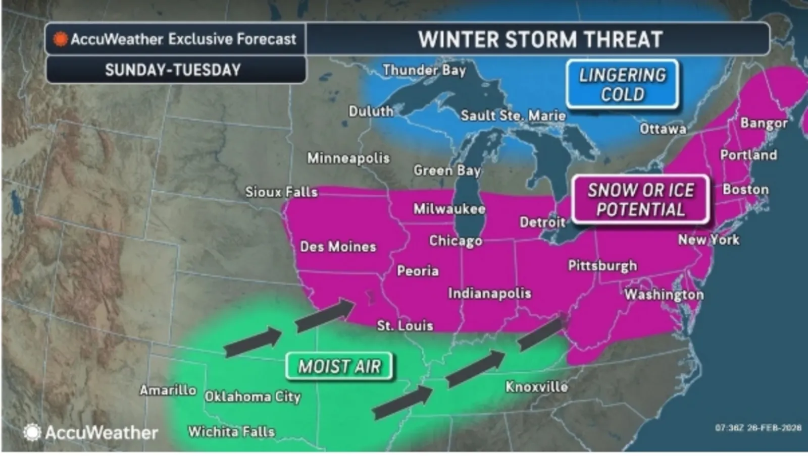
A powerful blast of Arctic air moving into the United States early next week is expected to fuel a winter storm capable of dropping snow and ice across 22 states, bringing hazardous travel and disruptive conditions from the Midwest to the Northeast.
Meteorologists say the system is forming on the heels of several smaller rounds of snowfall set to sweep the region through the weekend, laying the groundwork for a more significant and far-reaching event. The new winter storm comes as much of the Northeast remains buried under heavy snowfall that walloped the region earlier this week, with more than 3 feet of snow in some of the hardest hit areas.
Fresh Arctic air surging south from Canada will collide with warm, moist air advancing from the west and south, creating a broad zone of wintry precipitation. According to AccuWeather, the storm will begin taking shape after a series of minor snow bands pass through states from South Dakota to the Ohio Valley and from Montana into the Upper Midwest, each producing light accumulations of up to a couple of inches. As temperatures plunge on Sunday and Monday—dropping into the 20s in parts of the Northeast after briefly nearing 50 degrees in some cities—conditions will be primed for widespread snow, sleet, and freezing rain.
Read More on Weather
...
"With fresh Arctic air in place, warm and moist air colliding with the cold air may produce widespread snow, sleet and freezing rain across parts of the Great Lakes and Northeast," AccuWeather said in an email sent to reporters. "Snow and ice totals will depend on the storm’s track and strength. Some areas that missed the recent Blizzard of 2026 could receive several inches of snow and/or some ice this time."
Snowfall could reach more than 6 inches in some areas, with southeastern New England at the greatest risk for heavier amounts, AccuWeather meteorologist Bernie Rayno said in a video forecast on Wednesday.
The resulting impacts have a chance at affecting people within 22 states, including: far southern Minnesota, Iowa, Missouri, Wisconsin, Illinois, Michigan, Indiana, Ohio, Kentucky, Pennsylvania, West Virginia, Virginia, Maryland, Delaware, New Jersey, New York, Connecticut, Rhode Island, Massachusetts, Vermont, New Hampshire and Maine.
Major metro areas from Chicago and Detroit to interior sections of New York and New England may experience slippery roads, rapid freeze‑ups, and travel delays as the early‑week storm intensifies.
...
However, as of Thursday morning, there are no winter weather alerts in place across the region from the National Weather Service (NWS). Alerts such as winter weather advisories may be issued as the storm gets closer, depending on the severity of the forecast.
Despite the lack of current advisories, the NWS Weather Prediction Center shows widespread chances that states in the forecast region will experience at least minor winter weather impacts beginning on Sunday. Impacts intensify on Monday and Tuesday, then fade on Wednesday.
Given the storm is days away, there's still a chance for the forecast to change. People residing in the forecast region are urged to stay up to date with their local weather forecasting office and remain on alert for any advisories that may be issued.
View 0 Comments
Submit Correction
View Editorial & AI Guidelines