10
Loading video...

By Anna Skinner
Associate News Editor
0
Share
Newsweek is a Trust Project member
See more of our trusted coverage when you search.Prefer Newsweek on Googleto see more of our trusted coverage when you search.
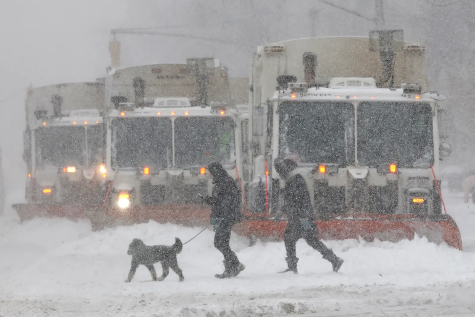
Chances are increasing that a "significant" winter storm will hit the Eastern Seaboard this weekend, only a week after Winter Storm Fern ravaged the U.S. South and Mid-Atlantic with heavy snow and sheets of ice.
The concerning forecast comes as millions of Americans are left reeling from the catastrophic impacts of Winter Storm Fern. The storm's death toll has risen to at least 30 people, and hundreds of thousands remain without power on Tuesday as extreme cold keeps power lines encased in ice. Extreme cold warnings and winter weather advisories remain in place across the South and Southeast, with meteorologists warning of a new winter storm threat that could hit millions this weekend. AccuWeather senior meteorologist Tom Kines told Newsweek that the worst impacts from the incoming storm likely wouldn't significantly affect the hardest hit areas from Winter Storm Fern over the weekend.
...
Read More on News
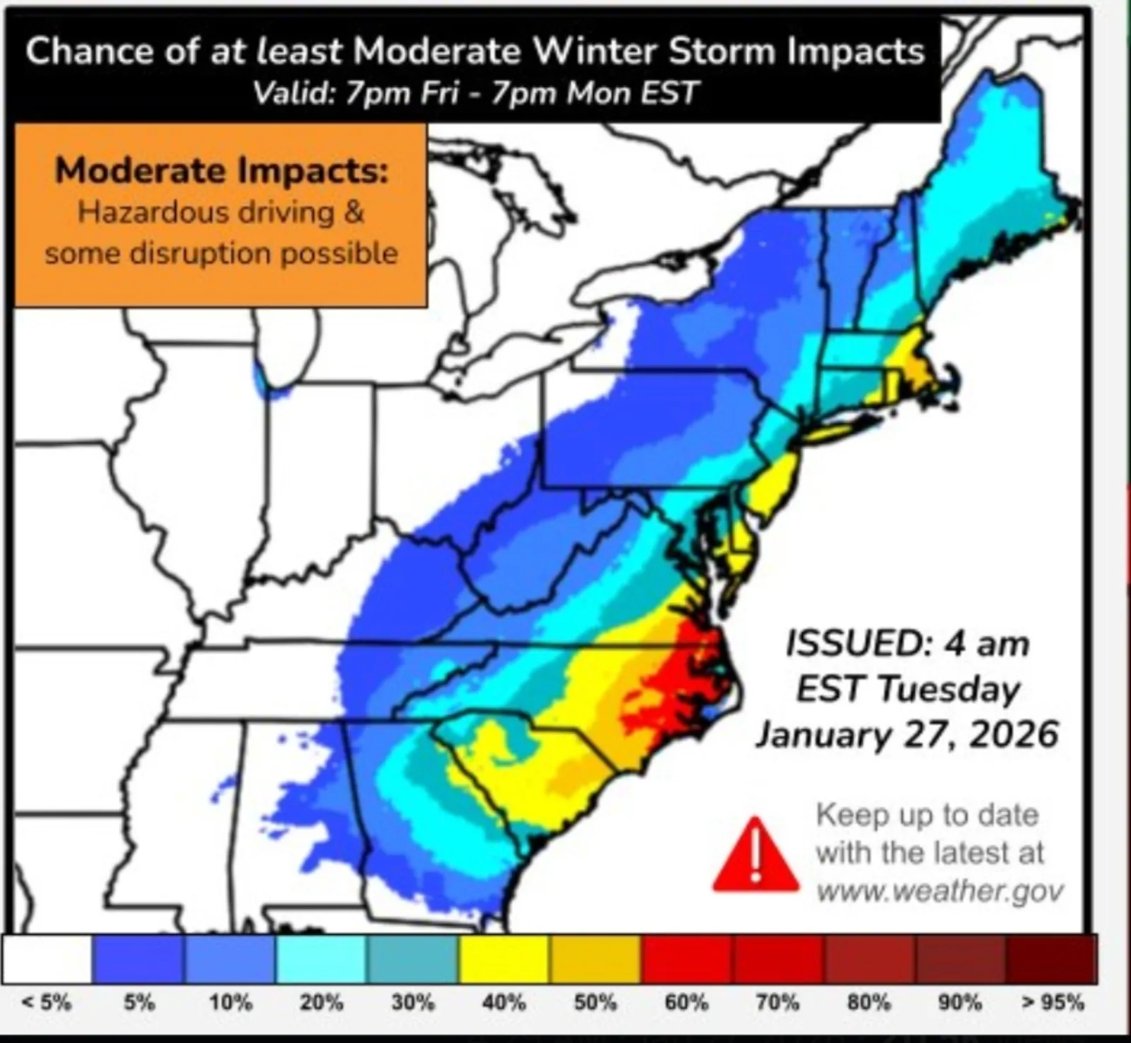
A new forecast map shared by the National Weather Service (NWS) Weather Prediction Center showed that there is a 60 to 70 percent chance of at least moderate impacts being felt in North Carolina and Virginia this weekend. Lower chances of much more widespread impacts are expected from Southern Georgia north through Maine.
...
"Here is the latest information regarding a potentially significant coastal storm this weekend," the NWS Weather Prediction Center said in a post on X. "Chances have increased for impactful snow and/or wind along the immediate East Coast, but uncertainty remains rather high with respect to details. Be sure to keep checking for updates!"
Within the post, messaging warned that a "strong surface low-pressure system is expected to rapidly develop off the Southeast Coast Saturday and move off the Mid-Atlantic Sunday, prompting widespread gusty winds."
"This surface low interacting with the very cold air mass will result in widespread heavy precipitation," the forecast said.
However, meteorologists still remain unclear about the storm's track and strength. Precipitation amounts and exactly where the worst precipitation will fall also remain unknown. Early forecast models are indicating that North Carolina's Outer Banks could see up to 6 inches of snow, which would be a "rare" event for the area, MyRadar senior meteorologist Matthew Cappucci posted on X.
"Snow is likely in eastern North Carolina, and there's a roughly 1 in 3 chance of seeing 6 inches or more in the Outer Banks," Cappucci posted on X. "That's pretty impressive, considering how rare plowable snows are. Technically, Hatteras's seasonal average is 1.2 inches of snow. About 70 percent of years, they get nothing. But once every decade on average, a plowable, bigger snowstorm occurs."
View 0 Comments
Submit Correction
View Editorial & AI Guidelines