...

By Anna Skinner
Associate News Editor
0
Share
Newsweek is a Trust Project member
See more of our trusted coverage when you search.Prefer Newsweek on Googleto see more of our trusted coverage when you search.
Violent thunderstorms tore across wide swaths of the Central and Midwestern United States overnight, leaving behind wind damage, large hail, and scattered tornado reports as communities began surveying destruction Tuesday morning.
According to preliminary storm reports from the National Weather Service’s (NWS) Storm Prediction Center, dozens of damaging wind and hail reports were logged across states including Missouri, Illinois, Iowa, Indiana and Wisconsin as a powerful weather system swept eastward late Monday into early Tuesday. The outbreak was part of a broader multiday severe weather pattern that has placed millions under repeated storm threats.
“Storms spun up several tornadoes Monday night, unleashed hail up to 4 inches in Missouri and brought wind gusts near 80 mph to Illinois," AccuWeather senior meteorologist Dan Pydynowski told Newsweek. "More than 100 hail reports and 150 damaging wind reports came in Monday alone, with at least 30 tornadoes reported nationwide since Friday.”
Read More on Weather
...
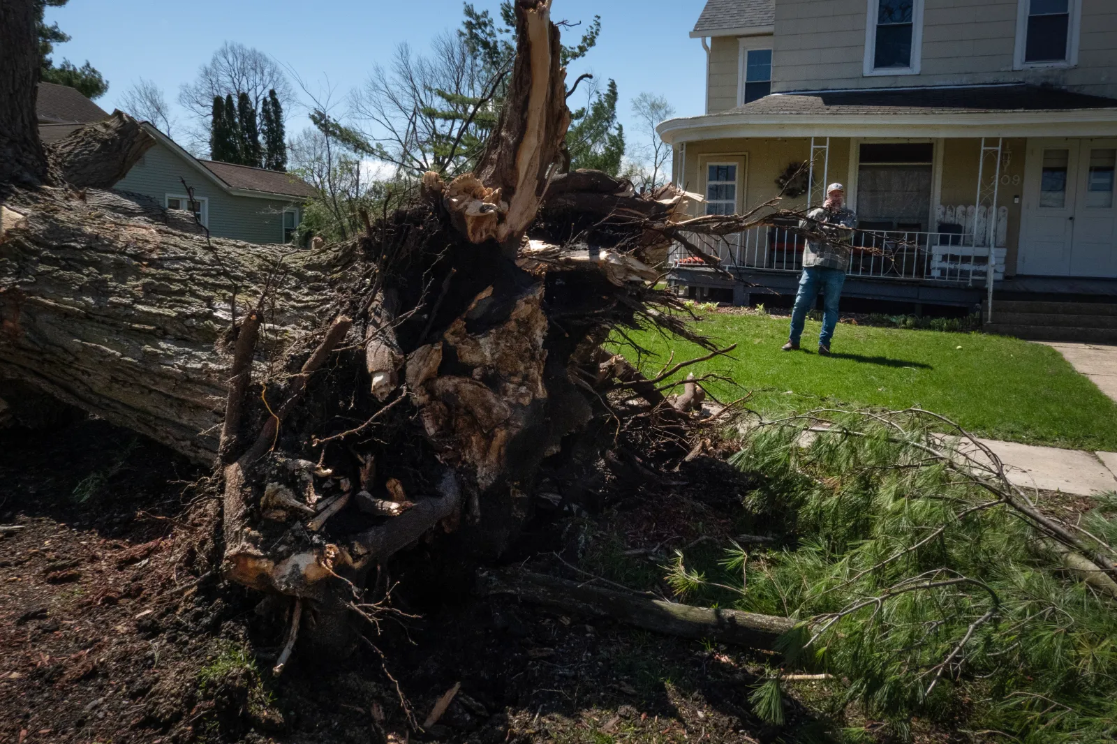
Emergency officials across the region reported downed trees, power lines and structural damage after storms produced powerful straight‑line winds, while hail ranging from quarter-sized to larger stones damaged vehicles, roofs and crops in several states. Social media photos and videos showed large trees uprooted. In some cases, the trees had fallen across houses and cars.
In Indiana, Greenwood Community High School is operating on a synchronous learning schedule on Tuesday because of damage sustained to its roof and auditorium during the storms.
Meteorologists warned ahead of the event that atmospheric conditions were favorable for “all modes of severe weather,” including destructive winds, very large hail and a risk of tornadoes, particularly as storms organized into fast‑moving lines during the evening hours. The Storm Prediction Center had issued elevated severe weather risk levels across parts of the Midwest ahead of the outbreak.
Power Outage Map as 210,000 Still Without Power
Nearly a quarter million people are still without power on Tuesday morning, according to data from poweroutage.us. The most widespread outages are reported in Indiana and Michigan, with thousands also without power in Missouri, Tennessee, Kentucky, and Ohio.
"More than 300 of our crews will be working through the night, stepping into the dark to restore power after strong storms swept across the state tonight. Those high winds—reaching over 70 mph in some areas—are expected to continue through 5 a.m. Tuesday, making restoration work challenging and, at times, dangerous," Consumers Energy posted on X after the storms hit Michigan. "Our lineworkers are trained for these conditions, but safety always comes first. Please stay far away from downed power lines and trees, and assume anything on the ground could be energized."
Tornadoes Reported in Arkansas and Illinois
While tornado reports remained under review early Tuesday, local NWS offices confirmed storm damage consistent with severe wind and rotating thunderstorms in parts of Arkansas and Illinois, where some areas were under tornado or severe thunderstorm warnings overnight. Officials cautioned that damage surveys are ongoing and that report tallies may change as assessments continue.
One of the reports was for Craighead, Arkansas, where there were "multiple reports of a rope tornado" near Highway 1 and County Road 452, according to the storm report.
No immediate fatalities were confirmed in relation to Monday night’s storms, though officials emphasized that assessments were still in their early stages.
AccuWeather assessed the storm reports and compiled the following list:
- Over 200 damaging wind reports from Missouri to Indiana Monday afternoon and night.
- Over 200 hail reports from northeastern Texas to Wisconsin Monday afternoon and night.
- Over 30 tornado reports across the Plains and Midwest from Friday afternoon through Monday night.
- An 80 mph wind gust occurred near Latham, Illinois, Monday evening.
- An 80 mph wind gust occurred near Macon, Illinois, Monday evening.
- 4-inch hail was observed near Piney Park, Missouri, Monday evening.
- 3.5-inch hail was observed near Versailles, Missouri, Monday evening.
- 3.5-inch hail was observed near Commerce, Texas, Monday evening
Tuesday's Forecast as More Storms Expected
The system is expected to continue shifting southeast later Tuesday, extending the threat of severe weather into parts of the Mid‑South and lower Mississippi Valley, according to forecasters. Residents across affected regions were urged to remain weather-aware as cleanup efforts begin and additional rounds of storms remain possible.
“The storm threat shifts east Tuesday, with damaging winds, large hail, tornadoes and flooding possible from Dallas to Shreveport to Little Rock," Pydynowski said. "The strongest storms may erupt after dark.”
Severe thunderstorm watches are currently in place for Texas, Oklahoma, Missouri, and Arkansas. They will remain in place until either 1 p.m. or 6 p.m. Central time depending on the location.
View 0 Comments
Submit Correction
View Editorial & AI Guidelines