...

By Sam Stevenson
Associate News Editor
0
Share
Newsweek is a Trust Project member
See more of our trusted coverage when you search.Prefer Newsweek on Googleto see more of our trusted coverage when you search.
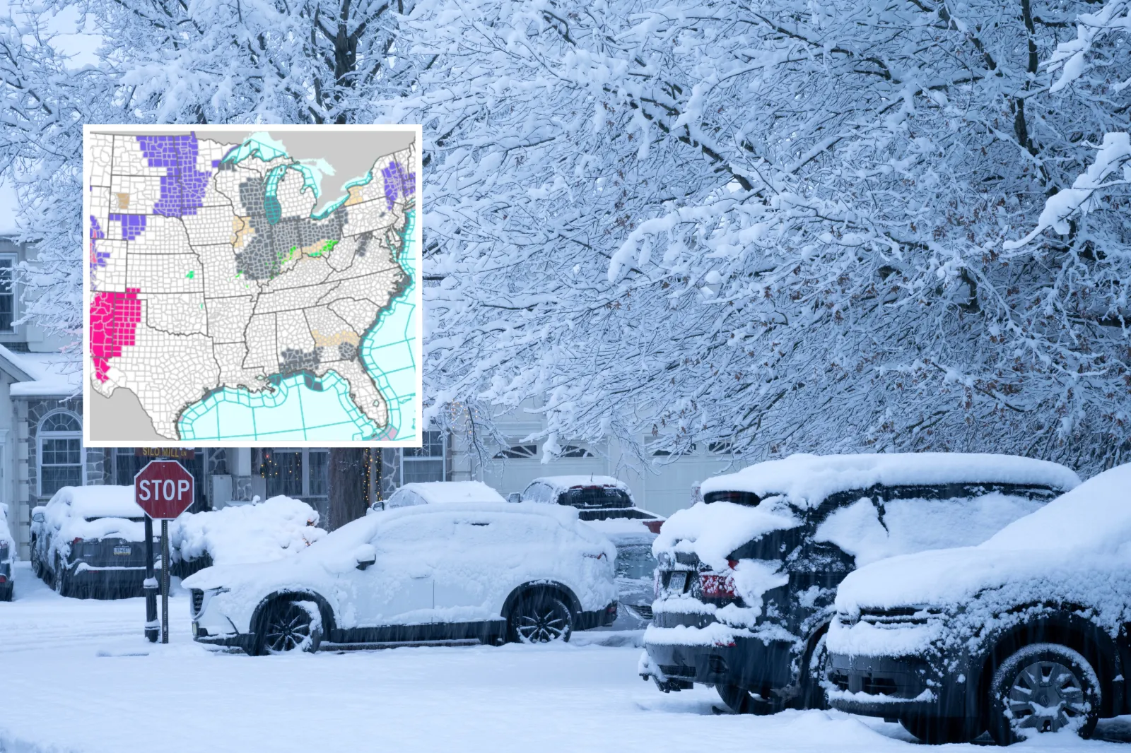
Winter storm warnings have been issued across the Rockies and Alaska on Friday, with some mountain zones forecast to pick up as much as 14 inches of snow and hazardous travel.
Winter storm warnings and winter weather advisories are in effect across Alaska, Colorado, Montana, Wyoming, Utah, Nebraska, North Dakota, Minnesota, South Dakota, New York, Pennsylvania, Connecticut, Massachusetts, Rhode Island, New Hampshire and Maine, bringing snow, ice, strong winds and hazardous driving conditions.
The National Weather Service (NWS) has warned that commutes and mountain travel could turn treacherous fast, saying in one alert that it “could be very difficult.”
Read More on News
NWS alerts warn of widespread winter weather, including heavy snow, freezing rain, blowing snow, strong winds and reduced visibility, with dangerous travel conditions expected across multiple regions through Friday and into the weekend.
...
Colorado
A winter storm warning for Colorado’s Southern Front Range Foothills was issued at 12:50 a.m. MST Friday and set to expire at midnight MST Friday, calling for an additional 8 to 14 inches of snow and noting road closures were possible.
A second winter storm warning (also issued 12:50 a.m. MST Friday, through midnight MST Friday) covered high terrain, including Rocky Mountain National Park and Summit County ranges, with 6 to 14 inches forecast and the same “very difficult” travel message tied to commute windows.
Colorado also had multiple winter weather advisories that paired lighter totals with commute impacts: one advisory for Denver-area corridors was issued 12:50 a.m. MST Friday, ran 5 a.m. to 8 p.m. MST, and forecast 3 to 5 inches with gusts up to 35 mph east of I‑25.
Other Colorado advisories (variously issued 12:50 a.m. MST Friday and running into midnight MST Friday, and Pueblo/Grand Junction mountain advisories running into Friday night) included pockets of 4 to 12 inches and gusts as high as 45 mph in higher passes, with repeated warnings that roads could turn slick and visibility could drop in blowing snow.
Alaska
A winter storm warning for parts of the Kenai Peninsula was issued at 2:53 p.m. AKST Thursday and set to run from 11 p.m. Thursday to 9 p.m. AKST Friday, forecasting 5 to 10 inches of snow, gusts up to 35 mph, and visibility down to one half-mile or less at times.
Another Alaska winter storm warning (Eastern Alaska Range south of Trims Camp) was issued at 2:44 p.m. AKST Thursday and set for 3 a.m. Friday through 9 p.m. AKST Saturday, with 5 to 10 inches forecast and gusts up to 40 mph, plus blowing and falling snow reducing visibility to one half-mile or less at times.
Several winter weather advisories have been issued across Southcentral Alaska, including one issued at 2:53 p.m. AKST Thursday (effective 11 p.m. Thursday to 7 p.m. AKST Friday) that forecasts 6 to 18 inches near Portage/Turnagain Pass and wind gusts as high as 60 mph through Eastern Turnagain Arm, with potential damage to trees and power lines.
Other Alaska advisories were set mainly from late Thursday night into Friday (and several through 5 a.m. AKST Saturday), with typical snow ranges including 7 to 14 inches (Tyonek), 8 to 16 inches (Thompson Pass/Ernestine), and gusts up to 50 mph in some passes alongside warnings about near-whiteout conditions in heavier bursts.
Montana
A winter storm warning for the Absaroka/Beartooth Mountains was issued at 10:38 p.m. MST Thursday and set to expire at 11 a.m. MST Friday, with 5 to 10 inches of additional snow and a note that blowing snow could significantly reduce visibility.
A second Montana winter storm warning for the Crazy Mountains (also issued 10:38 p.m. MST Thursday, until 11 a.m. MST Friday) called for periods of heavy snow with additional accumulations up to 4 inches and gusts up to 35 mph, while also flagging increased avalanche danger in the high country.
Separate winter weather advisories in the same Billings-area suite were shorter-duration (several through 9 a.m. MST Friday, and one through 3 p.m. MST Friday) and generally lower totals—often up to 2 inches in lower valleys—though one advisory for the Pryor/Northern Bighorn Mountains cited 4 to 8 inches and warned travel on US‑14 could be “very difficult” due to snow and blowing snow.
Wyoming
A winter storm warning for the South Laramie Range was issued at 1:20 a.m. MST Friday and set to expire at midnight MST Friday, forecasting 4 to 7 inches and wind gusts up to 40 mph around the Interstate 80 Summit between Cheyenne and Laramie.
Winter weather advisories (many issued 1:20 a.m. MST Friday) largely run until 6 p.m. MST Friday or until midnight MST Friday, with recurring snow ranges such as 3 to 6 inches (Central Laramie County/South Laramie Range Foothills) and gusts up to 45 mph, alongside warnings about blowing snow, reduced visibility, and slick bridges.
Riverton-area Wyoming advisories (issued 10:42 p.m. MST Thursday) extend into Friday afternoon in places, including a Wind River Mountains advisory that warned travel over South Pass could be “very difficult,” with 3 to 6 inches along the eastern slopes.
New England
A wide winter weather advisory covering parts of Connecticut, Massachusetts and Rhode Island was issued at 10:28 p.m. EST Thursday and set to expire at noon EST Friday, calling for a mixed bag of snow/sleet plus ice, with one segment noting ice accumulations around three-tenths of an inch and a risk of ice damage in higher terrain.
New Hampshire also had an advisory issued 11:41 p.m. EST Thursday and running until 1 p.m. EST Friday, projecting 2 to 5 inches of storm-total snow plus sleet and a light glaze of ice, while warning that untreated side roads could turn slick.
Northern Maine’s advisory was scheduled later: it was issued at 12:48 a.m. EST Friday and set for 6 a.m. to 1 p.m. EST Saturday, focusing on mixed precipitation with ice up to one-tenth of an inch and slippery travel.
Upper Midwest and Plains
Advisories in Minnesota range from short-lived early-morning freezing drizzle (some expiring 9 a.m. CST Friday) to longer-running wintry-mix alerts that were timed for Friday afternoon into Saturday morning, often mentioning a light glaze of ice and up to a few inches of snow.
South Dakota advisories were largely framed around mixed precipitation, patchy blowing snow and gusts up to 35 mph, with start times including 9 a.m. Friday in some counties and expiration windows stretching into early Saturday.
Nebraska’s advisory (North Platte forecast area) was issued at 2:03 a.m. CST Friday and set to run until noon CST Saturday, calling for mixed precipitation with 2 to 4 inches of snow plus a light glaze of ice and gusts up to 45 mph that could produce blowing snow and reduced visibility.
North Dakota advisories (from Grand Forks and Bismarck forecast areas) emphasized freezing drizzle and slick bridges in the early-morning window, with some set to expire by 6 a.m. CST or 9 a.m. CST Friday.
New York and Pennsylvania
Binghamton-issued winter weather advisories for parts of New York and northeast Pennsylvania were issued at 4:16 a.m. EST Friday and set to expire at 10 a.m. EST Friday, warning of freezing rain with a light glaze of ice and slippery roads for the morning commute.
Albany-area advisories were broader and ran later in the morning, including a multi-state advisory issued at 12:48 a.m. EST Friday and set to expire at noon EST Friday, citing mixed precipitation and ice accumulations up to two-tenths in some higher terrain areas.
Utah
Utah’s winter weather advisories (issued 10:15 p.m. MST Thursday) largely ran through 5 a.m. MST Friday in some valleys and 5 p.m. MST Friday in mountain zones, with several areas calling for 2 to 8 inches and “locally up to 10 inches” in favored terrain.
View 0 Comments
Submit Correction
View Editorial & AI Guidelines