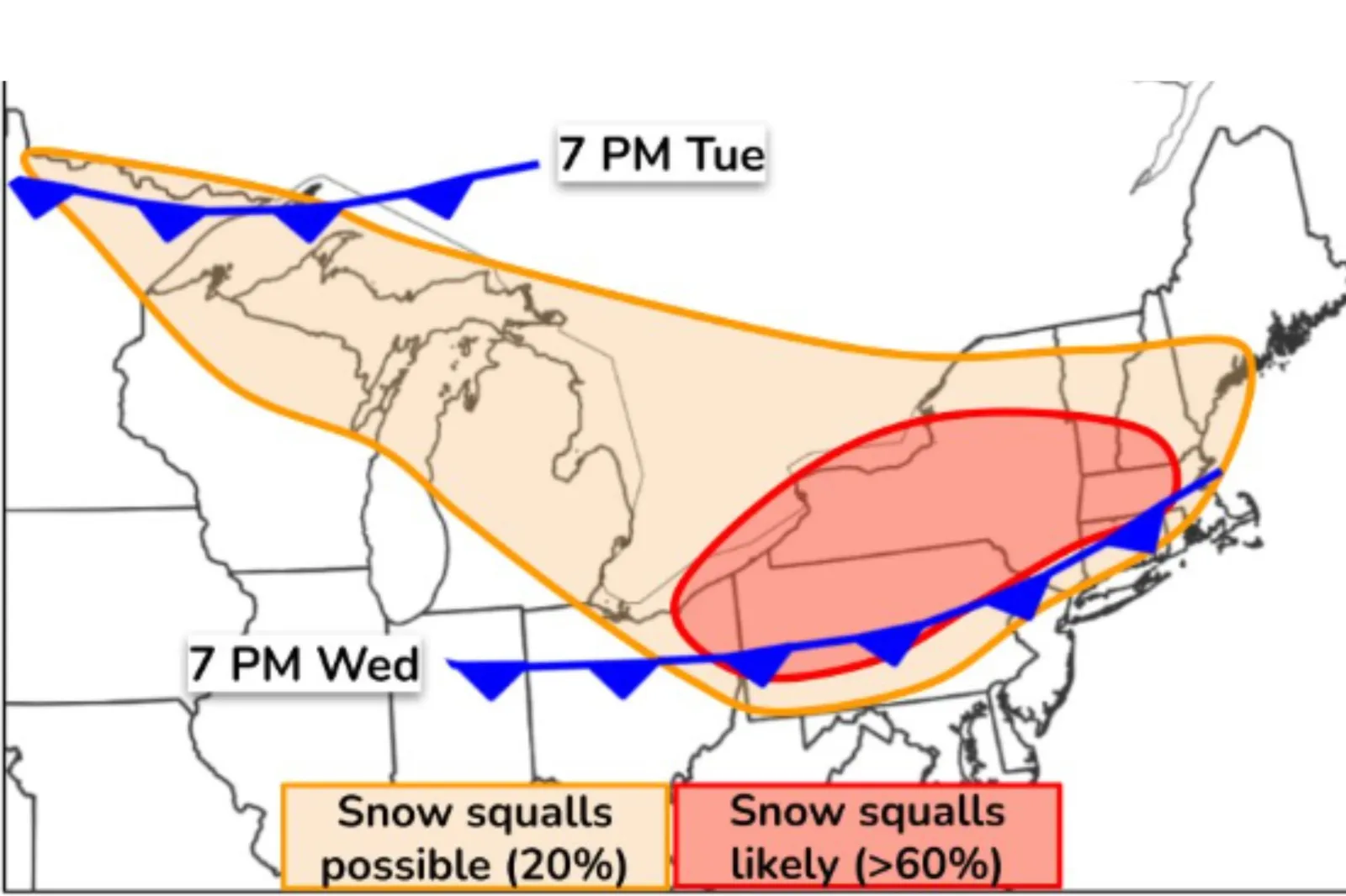
NWS/NWS Snow Squall map

By Joe Edwards
Reporter
0
Share
Newsweek is a Trust Project member
See more of our trusted coverage when you search.Prefer Newsweek on Googleto see more of our trusted coverage when you search.
Multiple states in the Northeast could see snow squalls through Wednesday, posing a danger for drivers, the National Weather Service (NWS) has forecast.
Why It Matters
The NWS warns that snow squalls can be extremely hazardous. They create snow-covered roads, rapidly changing conditions, and near-zero visibility. Flash freezing may also occur on roadways.
Read More on News
Additionally, Winter weather can present health risks for vulnerable groups such as young children and senior citizens.
What To Know
"An Arctic cold from passage continues the potential for snow squalls into midday for Upstate New York, interior New England and the northern Mid-Atlantic," the NWS said in an update on Tuesday.
A secondary Arctic front is expected to bring another round of widespread snow squalls from Tuesday evening through Wednesday, impacting areas near the Great Lakes, the northern Mid-Atlantic, and New England, it said.
These snow squalls could lead to hazardous travel conditions, it warned.
A forecast map suggested the areas most likely to see snow squalls included New York, Pennsylvania, Vermont, New Hampshire, Massachusetts, and a northeastern part of Ohio.
The NWS said probability of snow squalls was greater than 60 percent.
There was also a chance, albeit a lower one, for snow squalls in surrounding states, including Michigan, Wisconsin, Connecticut, and Maine.
A snow squall is a short but intense period of moderate to heavy snowfall and strong winds, creating whiteout conditions that can lead to hazardous traffic accidents.
What People Are Saying
AccuWeather meteorologist Brandon Buckingham told Newsweek: "The risk for the most intense squalls is expected in places like Detroit, Cleveland and Syracuse Wednesday morning, then this risk will shift southeast towards the Eastern Seaboard during the afternoon.
"There is a risk for snow showers and squalls to make it to places like New York City and Boston during the afternoon, potentially within a few hours of the peak afternoon commute time frame."
NWS Detroit said on X: "A clipper will bring 1-3" of snow to the Tri Cities and northern Thumb today. Gusty winds to 30 mph may increase to 40 mph behind a cold front tonight. Lake effect snow showers will develop tonight and taper off Wednesday morning."
What Happens Next
If you encounter a snow squall while driving, the NWS advises to pull over safely and wait for conditions to improve.
Do you have a story we should be covering? Do you have any questions about this article? Contact LiveNews@newsweek.com
View 0 Comments
Submit Correction
View Editorial & AI Guidelines