...

By Anna Skinner
Associate News Editor
0
Share
Newsweek is a Trust Project member
See more of our trusted coverage when you search.Prefer Newsweek on Googleto see more of our trusted coverage when you search.
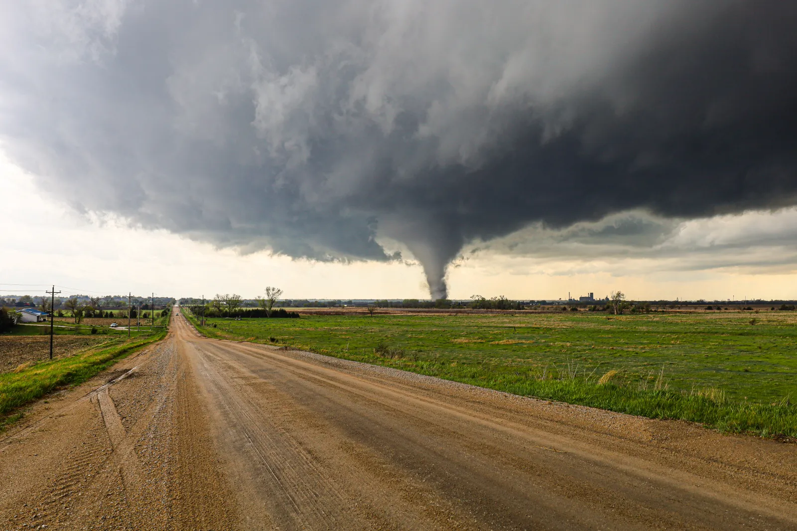
A spring storm system will trek across the Midwest on Thursday, with meteorologists warning those within its path that they could see isolated tornadoes.
The incoming storm system comes as the region has already seen an active year for tornadoes, with 190 having already been reported so far in March, according to the National Weather Service (NWS) Storm Prediction Center. Most of these damaging storms occurred in the Southern Plains, Midwest, and U.S. South.
Abnormally warm temperatures earlier this month helped fuel the storm systems. Above-average temperatures will once again sweep across the region on Thursday, with several temperature records likely to be broken, which could fuel the incoming thunderstorms, NWS meteorologist Matt Barnes told Newsweek.
Read More on Weather
"We could perhaps even set record high temperatures for the entire month of March," Barnes, who works at the NWS office in Lincoln, Illinois, said. "This very warm and humid air mass is definitely going to be fueling those storms as we get later in the day on Thursday."
...
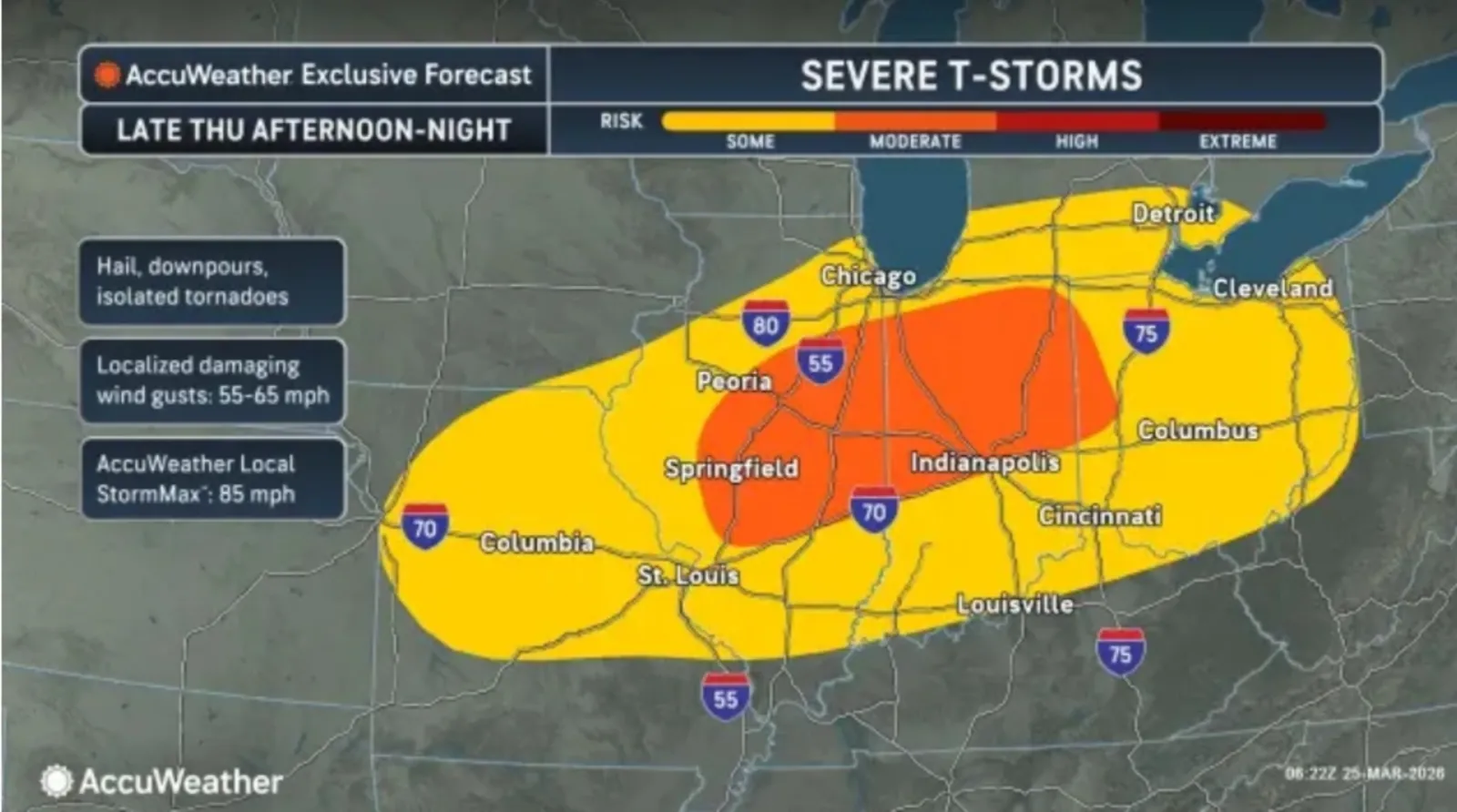
NWS meteorologists across the region issued hazardous weather outlooks on Wednesday, warning of the incoming threat that could bring scattered thunderstorms across the area as early as Wednesday night, before a more severe system rolls through on Thursday. AccuWeather also provided a forecast about the incoming storms, sharing a map that revealed three states at a moderate risk of severe thunderstorms that could produce isolated tornadoes.
The states most at risk for the tornado threat are Illinois, Indiana, and Ohio, according to the AccuWeather map, although a much more widespread area faces "some" risk, including parts of Missouri, Iowa, Kentucky, and Michigan.
...
In some cases, the storms could produce large hailstones, the NWS office in Lincoln said in the hazardous weather outlook.
"Hail larger than golf balls will be possible with the strongest storms, and a few tornadoes are also possible. As the evening progresses, the severe weather threat will trend toward damaging winds," the outlook said.
In Indiana, the strongest storm threat would be on Thursday and Thursday night.
"Large hail and damaging wind gusts are the primary threats, but an isolated tornado threat cannot be ruled out," NWS Indianapolis said.
Meanwhile, the NWS office in Wilmington, Ohio, said the storm threat could take shape as soon as Wednesday.
"Thunderstorms will occur along and behind a cold front that will cross in the evening and overnight hours," the office said in the hazardous weather outlook. "Damaging wind and very heavy rainfall is the primary threat. Large hail and an isolated tornado could occur early in the development of these storms."
In a polarized era, the center is dismissed as bland. At Newsweek, ours is different: The Courageous Center—it's not "both sides," it's sharp, challenging and alive with ideas. We follow facts, not factions. If that sounds like the kind of journalism you want to see thrive, we need you.
When you become a Newsweek Member, you support a mission to keep the center strong and vibrant. Members enjoy: Ad-free browsing, exclusive content and editor conversations. Help keep the center courageous. Join today.


View 0 Comments
Submit Correction
View Editorial & AI Guidelines