...

By Anna Skinner
Associate News Editor
0
Share
Newsweek is a Trust Project member
See more of our trusted coverage when you search.Prefer Newsweek on Googleto see more of our trusted coverage when you search.
A rare "particularly dangerous situation" label was attached to a tornado watch that went out for parts of Nebraska and Kansas on Monday during a multi-day severe weather event in which meteorologists warned tornado outbreaks were possible.
National Weather Service (NWS) meteorologists at the Storm Prediction Center stressed that a tornado watch over central and northeastern Kansas and southeastern Nebraska could erupt into a "particularly dangerous situation" as elements came together to create the ideal environment for tornadoes to form.
Read More on Weather
To make matters for dangerous, multiple tornado warnings were in effect Monday afternoon across parts of Kansas and southeastern Nebraska as severe thunderstorms with strong rotation moved northeast at around 25 to 35 mph, according to NWS tornado warnings. In Kansas, a tornado warning remained active until 4:15 p.m. CDT for portions of Washington, Clay and Cloud counties, where a storm near Miltonvale was capable of producing a tornado and up to 2-inch hail. Communities including Clay Center, Clyde and Clifton were in the projected path.
In Nebraska, several warnings covered areas of Gage, Johnson and Pawnee counties, including storms near Beatrice, Virginia and Wymore. Forecasters indicated multiple areas of rotation, with some storms described as having a history of producing tornadoes and capable of generating hail up to golf-ball size. Officials warned that flying debris poses a serious hazard and urged residents in affected areas to take immediate shelter in interior rooms or basements as the storms tracked through largely rural areas and small communities.
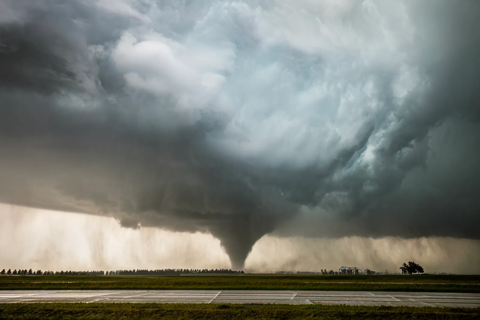
Tornado Spotted as Urgent Warnings Issued
One of the tornadoes was caught on a live stream video by independent meteorologist Max Velocity.
The urgent warning came several days after meteorologists warned that a potentially dangerous tornado outbreak could unfold across parts of the central United States over the next six days, placing millions of people in the path of severe storms capable of producing strong tornadoes, damaging winds and large hail.
The NWS and independent meteorologists have raised the alarm about the incoming weather threat. The warning underscores the potential for widespread, dangerous storms across a heavily populated stretch of the central U.S., where fast-moving tornadoes can develop with little notice. Forecasters said conditions could support significant severe weather, heightening the risk to lives, property and critical infrastructure if storms intensify as expected.
On Friday, the risk level worsened for parts of the Midwest.
The NWS Storm Prediction Center issued an updated forecast that showed nearly all of Iowa had been upgraded from a "slight" risk to an "enhanced" risk for severe weather on Friday for an area that encompasses more than 1.9 million people.
In earlier forecasts, the greatest risks were very large hail and severe winds. Now, a tornado is also possible, the updated forecast said.
Severe Thunderstorm Warning: What We Know
On Thursday evening, numerous severe thunderstorm watches were issued across north Texas, Oklahoma and Kansas, along with severe thunderstorm warnings by several NWS offices in Texas.
In most cases, the warnings were set to expire roughly an hour after they were issued and were associated with storms that could produce minor damage to homes, cars and trees.
"For your protection move to an interior room on the lowest floor of a building," the warning said.
More warnings will likely be issued as the storms progress, and the severity remains to be seen.
Tornado Outbreak Threat: What We Know
Tornadoes can occur at any time of year in the United States, but they are most common in spring, when warm, moist air from the Gulf of Mexico collides with cooler air from the north. Tornado activity typically peaks between April and June, with May historically the most active month, particularly across the central Plains and Midwest, according to the NWS.
Some parts of the Midwest, particularly Illinois, have already experienced a particularly damaging tornado season, with more than 100 twisters reported so far this year, far above the state's yearly average. Illinois and at least 10 other states across the Plains and Midwest will again see an increased chance of damaging and even deadly tornadoes over the next week, according to the forecasts.
...
"MULTI-DAY #TORNADO OUTBREAK POSSIBLE across the Central U.S. peaking Sunday-Monday!" extreme meteorologist Reed Timmer posted on X on Thursday. "We have six days in a row of severe weather and tornado potential starting with a gorilla hail threat in central Kansas this evening, with the central and southern Plains to Upper Midwest having a full-blown #tornado outbreak Saturday evening through Tuesday morning."
"An active severe thunderstorm pattern is expected through early next week," the NWS Storm Prediction Center posted on X. "Multiple days of severe storms are expected across portions of the Plains to the Mid/Upper Mississippi Valley starting today (Thursday 5/14) and persisting through Tuesday (5/19)."
Thursday: Thunderstorms and Hail Expected
The risk kicks off on Thursday, with the NWS Storm Prediction Center issuing a "slight" risk for severe weather across northern Texas, western Oklahoma and central Kansas.

...
"Thunderstorms with hail and severe wind gusts are possible from Kansas/Missouri southwest into west Texas, mainly late this afternoon and evening," the forecast said.
Tornado chances remains low, at less than 2 percent, the outlook showed.
Friday: Low Chance but 3 Million at Risk
On Friday, the greatest risk area shifts north to encompass northeastern Kansas, southeastern Nebraska, southern Iowa and northwestern Missouri.

...
The chance of tornadoes is again low, with NWS meteorologists warning of "severe storms with large to very large hail and severe wind gusts."
Nearly 3 million people reside in the slight risk area.
Saturday: 'A Strong Tornado Will Be Possible'
This is the first day in which the NWS Storm Prediction Center specifically warns that damaging tornadoes are possible.
"Severe storms capable of large to very large hail, wind damage and tornadoes will be possible Saturday afternoon and evening across parts of the central Plains and lower to mid Missouri Valley," the forecast said. "Hailstones up to 3 inches in diameter and a strong tornado will be possible."

More than 4.5 million people reside within the highest risk area. Omaha, Nebraska; Lincoln, Nebraska; Des Moines, Iowa; Cedar Rapids, Iowa; and Topeka, Kansas, are some larger population centers within the greatest risk area.
Looking further ahead, tornado risk will continue on Sunday and Monday for the northern Plains states and into the Missouri Valley, the NWS forecasts said.
Tornado Watch vs. Tornado Warning
As the storms develop, it's possible that local NWS offices will issue tornado watches or tornado warnings. A tornado watch means atmospheric conditions are favorable for tornadoes to form in and near the watch area, which often covers multiple counties or states and serves as a heads-up to stay alert and prepared. A tornado warning is more urgent and is issued when a tornado has been sighted or indicated by radar, signaling immediate danger to life and property and the need to take shelter at once.
Severe thunderstorm watches and warnings may also be issued.
How Does a Tornado Form?
A tornado typically forms within a severe thunderstorm, most often a supercell, when warm, moist air near the ground rises into cooler air aloft and encounters strong wind shear, or changes in wind speed and direction with height. This shear can cause the storm’s updraft to begin rotating, creating a spinning column of air inside the storm; under the right conditions, that rotation can tighten and extend toward the ground, producing a tornado. While many thunderstorms develop rotating features, only a small fraction produce tornadoes.
What Happens Next: Widespread Tornado Threat
People living within the impacted areas are encouraged to monitor local NWS forecasts and alerts as the storms progress. People should have multiple ways to receive weather alerts and be prepared to take shelter should a serious thunderstorm or tornado develop.
View 0 Comments
Submit Correction
View Editorial & AI Guidelines