...

By Anna Skinner
Associate News Editor
0
Share
Newsweek is a Trust Project member
See more of our trusted coverage when you search.Prefer Newsweek on Googleto see more of our trusted coverage when you search.
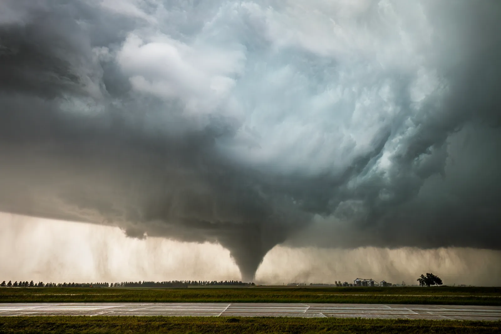
A dangerous round of severe weather is expected to erupt across the central and southern Plains on Wednesday, with forecasters warning that very large hail, damaging winds and a few tornadoes are likely by late afternoon.
The National Weather Service (NWS) said severe thunderstorms are expected to intensify through the evening, with additional storm development possible from the Ohio Valley into the Appalachians and Mid‑Atlantic. The severe weather outlook highlights a multi-state threat zone where tornadoes may form, prompting forecasters to urge residents to review safety plans and monitor real‑time watches and warnings.
While the highest impacts are expected across the Plains, strong to severe storms may spread eastward, affecting millions along a broad corridor stretching into the Ohio Valley and Mid‑Atlantic.
Read More on Weather
“Severe weather season is ramping up in full force this week, and it’s happening during one of the busiest travel periods of spring," AccuWeather director of forecasting operations Carl Erickson told Newsweek. "A volatile clash between building warmth and a surging push of chillier air, combined with moisture from the Gulf, will fuel multiple rounds of powerful and disruptive thunderstorms.”
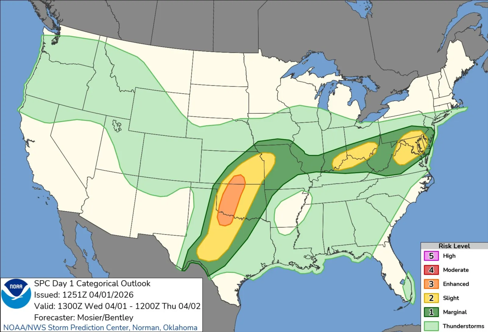
The NWS shared a post on X about the forecast on Wednesday morning. Included with the post was a map revealing the states at highest risk of severe weather as being south-central Kansas, central Oklahoma, and northern Texas.
An "enhanced" risk level was issued for these areas, with a "slight" risk extending further into Texas, as well as into Missouri, with separate "slight" risk pockets across Indiana, Ohio, Kentucky, and West Virginia, and Pennsylvania, Delaware, Maryland, and Virginia.
...
An "enhanced" risk is the third level on the NWS Storm Prediction Center's severe weather scale. It indicates numerous severe storms are expected, which could include damaging winds, hail, and tornadoes.
Storm chasers are already sounding alarms about the incoming storm system.
"DANGEROUS SEVERE WEATHER is shaping up for today across the Central and Southern Plains! Very large hail, damaging winds, and a few tornadoes are likely late this afternoon into the evening hours," meteorologist Max Velocity posted on X.
Where Is Tornado Alley?
Tornado Alley is a loosely defined region of the central United States where atmospheric conditions frequently favor tornado development. It generally includes parts of Texas, Oklahoma, Kansas, Nebraska and South Dakota, though the boundaries shift year to year based on weather patterns.
Warm, moist air from the Gulf of Mexico colliding with colder air from the north often creates the instability needed for powerful rotating thunderstorms, especially in spring.
...
Tornado Warning vs. Tornado Watch
A Tornado Watch means conditions are favorable for tornado formation. Watches often cover large areas and are issued hours before storms develop. People in a watch area should stay alert and prepare to act quickly.
A Tornado Warning means a tornado has been spotted or indicated by radar. Warnings are issued for small, specific areas and require immediate action—residents should seek shelter right away.
View 0 Comments
Submit Correction
View Editorial & AI Guidelines