...

By Joe Edwards
Reporter
0
Share
Newsweek is a Trust Project member
See more of our trusted coverage when you search.Prefer Newsweek on Googleto see more of our trusted coverage when you search.
Texas could be hit by severe thunderstorms this week, forecasters have predicted.
Why It Matters
Much of Texas has faced challenging winter weather this month, including snowstorms, and meteorologists have warned that the forecast thunderstorms could produce damaging winds and hail.
Read More on News
The severe weather may create unsafe travel conditions for people in the affected areas.
...
What To Know
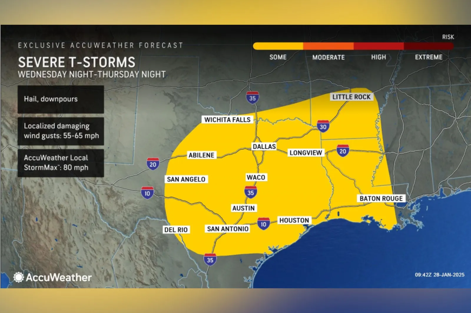
According to a forecast map produced by AccuWeather, beginning on Wednesday night, there is a risk of severe thunderstorms in an area that spans parts of central, eastern and southern Texas. The severe weather could last until Thursday night.
Cities in the affected area include Abilene, San Angelo, San Antonio, Austin, Waco, Dallas, Houston and Longview.
The map also showed that most of Louisiana could see thunderstorms, as well as the southern half of Arkansas.
The outlet warned of hail, downpours and localized damaging wind gusts reaching 55 to 65 miles per hour.
AccuWeather meteorologist Alexander Duffus told Newsweek that showers were anticipated to spread across central Texas throughout the day on Wednesday.
As moisture and instability increase in the afternoon, a line of thunderstorms is expected to develop from Abilene to San Antonio by Wednesday night.
This storm line is forecast to move eastward, bringing thunderstorms to the Dallas-Fort Worth and San Antonio areas by Thursday morning.
The thunderstorms could persist across the Dallas-Fort Worth and San Antonio metro areas for several hours in the morning, Duffus said, with the primary threat being flooding downpours. He added that the storms could produce damaging winds and hail.
What People Are Saying
AccuWeather meteorologist Alexander Duffus told Newsweek: "Showers and thunderstorms will advance across eastern Texas throughout the day on Thursday reaching Houston and Lufkin by the afternoon. There will be strengthening of thunderstorms, some strong, with enhanced low-level wind in the afternoon.
"This will then pose the risk of severe thunderstorms capable of producing damaging winds, hail and even isolated tornadoes, especially across southeastern Texas and Louisiana. These areas can see the strongest storm on Thursday afternoon and Thursday night."
The National Weather Service account for Houston said on X, formerly Twitter, on Tuesday: "Isolated rain showers will continue throughout the day and into tonight, which is when we add sea fog into the mix. Our focus remains on Thursday with the potential for strong to severe storms along a cold front. Stay weather aware and up to date on the latest forecast."
What Happens Next
The thunderstorms are forecast to develop by Wednesday. Residents can follow the NWS and local weather trackers to stay informed on developing conditions.
Do you have a story we should be covering? Do you have any questions about this article? Contact LiveNews@newsweek.com.
View 0 Comments
Submit Correction
View Editorial & AI Guidelines