...

By Pol Allingham, Zenger News
0
Share
Newsweek is a Trust Project member
See more of our trusted coverage when you search.Prefer Newsweek on Googleto see more of our trusted coverage when you search.
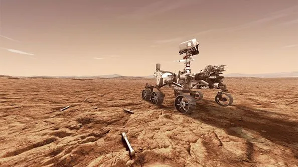
Budding astronauts can now experience the sights and even the sounds of Mars as they "hike" across the red planet, thanks to a new interactive map from NASA. The vast map encompasses the areas surrounding the landing site of NASA's Mars 2020 Perseverance rover.
Users can hike across and around the planet's Jezero crater using virtual reality, a regular laptop, or a phone. If they stand beside the Mars rover, they can even hear it working.
Steep slopes can be traversed and views can be taken in from large scales to centimeter-close detail. Users can stand on top of the Mars rover at ground level—just like street view on Google Maps—and stare across the surrounding desert landscape.
Read More
The Potential of Biomaterials for Human Space Exploration5 min read

Scientist Works Out There Is Over 15,000 Pounds of Human Trash on Mars3 min read

Tools Could Be 3D-Printed Using Dust From Mars, Study Reveals3 min read


...
People can then select higher altitudes and watch the mountainous terrain with recordings of the desolate planet in the background.
According to NASA, users staring at the Hogwallow Flats are looking at the remains of a delta from a river that flowed into Lake Jezero 3.5 billion years ago.
The sound is harsher and captures the rover rolling across this part of the Jezero crater. At other locations, people can hear the rover moving quietly until it has to engage its suspension on rougher terrain.
The epic creation was released at the Europlanet Science Congress (EPSC) 2022 in Granada, Spain, by Sebastian Walter of the Freie Universität Berlin.
"Some of the slopes are pretty steep, so watch out for those if you want to avoid too much oxygen consumption," Sebastian said, adding that "to get a real feeling of what to expect on your future Mars trip, you can click on one of the waypoint marker symbols to enter either a full-screen 3D view or, if you have a virtual reality setup, to enter a fully immersive environment."

...
"You can even listen to the sounds of the rover if you stand close by, but please don't touch it—otherwise you would contaminate the probes," he said.
The Jezero map builds on the European Space Agency (ESA)'s Mars Express mission, which has tried to bring three-dimensional images of Mars to the internet since 2004.
The other portion comes from the Mars Reconnaissance Orbiter, NASA's spacecraft sent to Mars to study geology in 2005.
"As the rover returns more and more high-resolution image data and even audio recordings, it turns out to be the perfect tool for immersive visualization of that data in a scientific context by itself," said Sebastian.
The Terrain Relative Navigation team of the Jet Propulsion Laboratory provided the HiRISE data.
Produced in association with SWNS Talker.
This story was provided to Newsweek by Zenger News.
View 0 Comments
Submit Correction
View Editorial & AI Guidelines