...

By Joe Edwards
Reporter
0
Share
Newsweek is a Trust Project member
See more of our trusted coverage when you search.Prefer Newsweek on Googleto see more of our trusted coverage when you search.
A mid-week winter storm is forecast to bring snow, ice, and rain impacts from the Midwest to the Northeast.
Why It Matters
Snow and ice can disrupt travel, creating dangerous driving conditions, the National Weather Service (NWS) warns, while winter storms may also cause power outages. Freezing temperatures may pose health risks, particularly for vulnerable groups such as infants and older adults.
Read More on News
What To Know
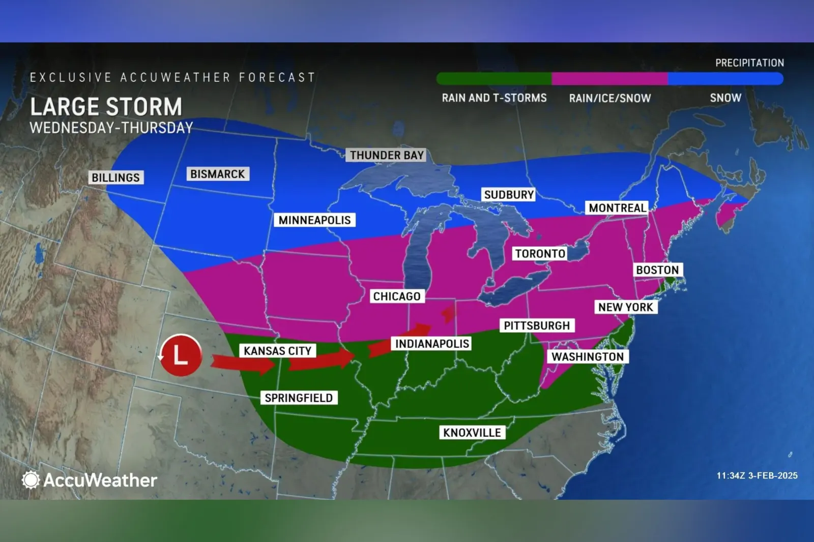
An AccuWeather forecast map, for Wednesday and Thursday, indicated that snow is expected in the northern areas of Maine, Michigan and Wisconsin. Snow is also forecast for both North and South Dakota, as well as Eastern Montana, Northeastern Wyoming, and Minnesota.
...
A mixture of rain, snow, and ice is possible in New Hampshire, Vermont, Connecticut, New York, and Nebraska. This was also forecast for the northern portions of Illinois, Indiana, New Jersey, and Ohio.
Meanwhile, rain and thunderstorms are expected for Tennessee, Kentucky, Virginia and West Virginia, as well as parts of North Carolina, Arkansas, Maryland, and the southern portions of Illinois, Indiana, and Ohio.
Pennsylvania, as well as parts of West Virginia and Maryland were under winter storm watch—signaling a possibility of "significant and hazardous winter weather" within the next 48 hours—from the NWS early Tuesday morning.

...
Another AccuWeather map detailed which parts of the country would see heaviest impacts from ice as a result of the winter storm.
States that could see more pronounced impacts included New York, Pennsylvania, West Virginia, Michigan, Maryland, and Virginia. Localized ice impacts were also forecast for Connecticut, Rhode Island, Massachusetts, Vermont, New Hampshire, Illinois, Iowa, Minnesota, and Missouri.
AccuWeather estimated that the impacts from snow and ice could affect more than 94 million people.
"AccuWeather expert meteorologists are forecasting an area of 1-3 inches of snow from eastern Montana into northern Michigan on Wednesday. A zone of 3-6 inches of snow is expected from northern North Dakota into the Upper Peninsula of Michigan," read an advisory shared with Newsweek.
The outlet also said "significant ice storm impacts" were expected for parts of the central Appalachians, extending through northern Pennsylvania and southern New York. Some areas could see ice accumulations of up to half an inch.
What People Are Saying
In an advisory provided to Newsweek, AccuWeather meteorologist Brandon Buckingham said: "As the mild air mass clashes with frigid air farther north, the ingredients for a major ice storm are expected to be in place beginning Wednesday across a zone spanning from the Midwest to the Great Lakes."
Buckingham added: "The potential exists for dangerous amounts of ice accretion into Thursday. This poses a risk for tree damage and power outages as the storm moves through"
The NWS said in an update: "[The] highest chances (40-70 percent) for more than 0.25 inches of ice accretion are forecast in western Maryland, the West Virginia Panhandle, and northward into central/southern Pennsylvania; resulting in the greatest potential for scattered power outages and tree damage."
NWS Pittsburgh said on X on Monday: "Keeping a close watch on the threat for freezing rain Wednesday night and Thursday morning. Timing issues still a problem as well as honing in on surface temperatures. We have issued a winter storm watch for areas with the highest probabilities to see freezing rain."
What Happens Next
Forecasts are subject to change, with organizations such as the NWS publishing regular updates.
Do you have a story we should be covering? Do you have any questions about this article? Contact LiveNews@newsweek.com
View 0 Comments
Submit Correction
View Editorial & AI Guidelines