AccuWeather

By Joe Edwards
Reporter
0
Share
Newsweek is a Trust Project member
See more of our trusted coverage when you search.Prefer Newsweek on Googleto see more of our trusted coverage when you search.
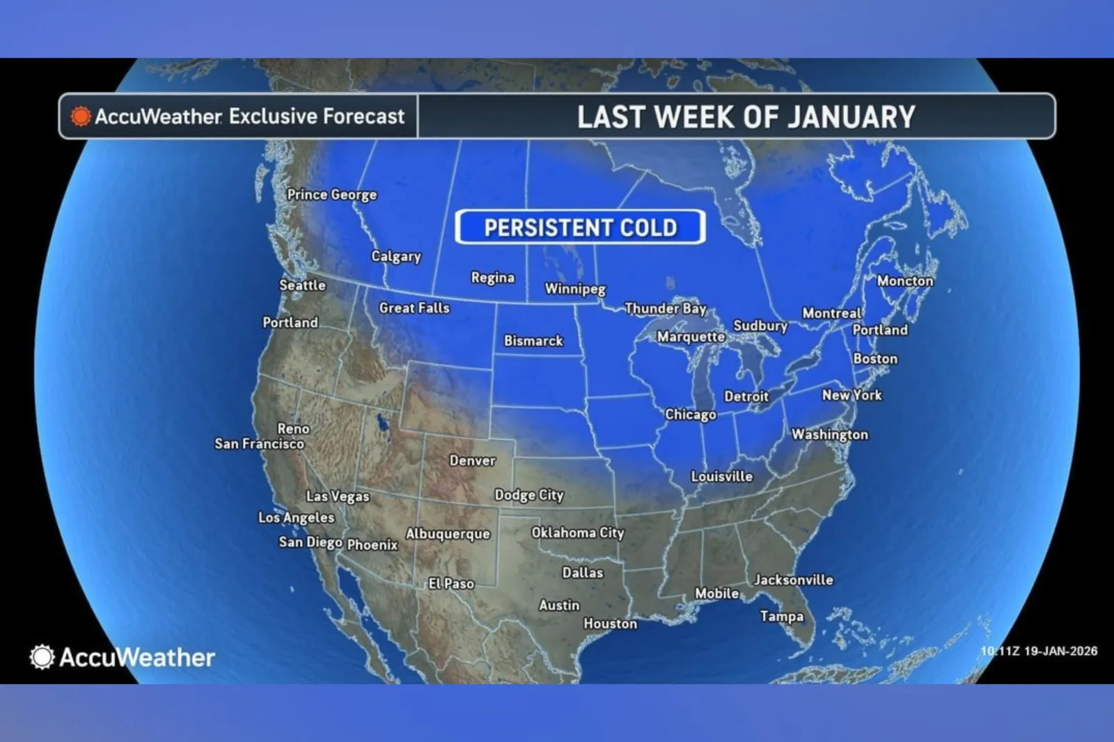
A forecast map reveals which states can expect to see "persistent cold" in the weeks ahead, after experts said the polar vortex would unleash waves of icy air across parts of the U.S. through January.
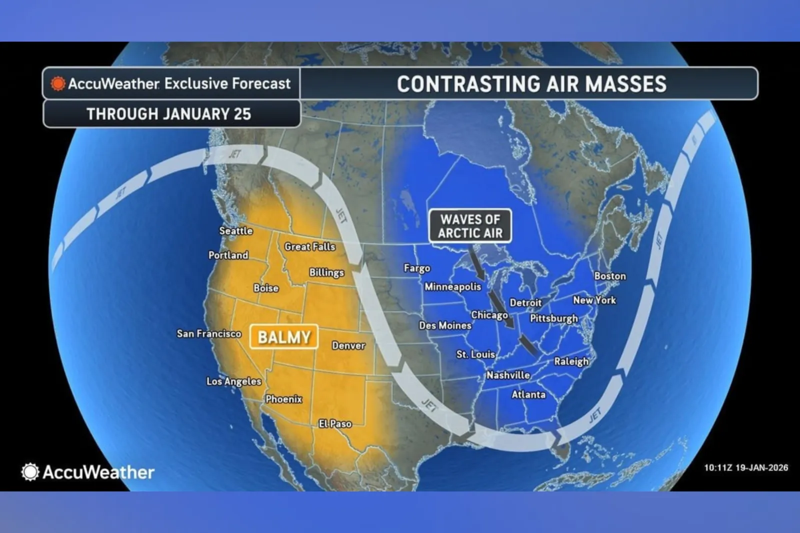
"Over the next couple of weeks, the jet stream will develop a large buckle with a northward bulge along the Pacific Coast and a southward dip centered on the Great Lakes," AccuWeather lead long-range meteorologist Paul Pastelok said in a January 13 report from the outlet. "This setup stretches the polar vortex, sending persistent warmth near the bulge and repeated shots of cold air through the dip."
More recently, Washington Post weather writer and meteorologist Ben Noll noted on Sunday that a “brutal polar vortex pattern shows no signs of easing across the United States through the end of January.”
Read More on News
According to a temperature outlook from the National Weather Service (NWS) Climate Prediction Center (CPC), for the January 24 to 28 period, the states most likely to see below-normal temperatures during this window include portions of the Great Plains, Midwest, and Northeast.

...
“Anomalous hazardous cold temperatures are anticipated to continue across the Midwest for late [January]," the agency said in an update on Friday. “Temperatures may fall below -20 degrees F across northern parts of North Dakota and Minnesota,” it added.
...
In an advisory shared with Newsweek on Monday, forecasters at AccuWeather said that a “persistent” Arctic cold pattern is expected to hold across the Midwest and Northeast through late January, boosting the likelihood of snow from any winter storms.
States potentially affected spanned much of the northern U.S. ranging from Montana to Maine in the north and as far south as Kentucky, the map showed.
...
What Is the Polar Vortex?
According to the National Weather Service (NWS), the polar vortex is a large area of low pressure and frigid air surrounding each of Earth’s poles. It is a year-round feature, though it weakens in summer and becomes more intense in winter.
The word 'vortex' refers to the counterclockwise circulation that helps confine this cold air near the poles. In many northern hemisphere winters, the polar vortex can stretch southward, allowing cold air to spill down with the jet stream.
This is a fairly common winter pattern and is often linked to major Arctic cold outbreaks in the U.S., the agency said.
View 0 Comments
Submit Correction
View Editorial & AI Guidelines