AccuWeather

By Joe Edwards
Reporter
0
Share
Newsweek is a Trust Project member
See more of our trusted coverage when you search.Prefer Newsweek on Googleto see more of our trusted coverage when you search.
A strong blast of Arctic air will drive temperatures sharply lower from the Midwest to the interior Northeast this weekend, bringing the season's coldest weather so far for many, forecasters say.
AccuWeather reports that a vast pocket of air 20–30 degrees below zero in northwestern Canada will surge into the U.S. late this week, delivering frigid conditions from the northern Plains into the Midwest and Appalachians.
According to AccuWeather meteorologists, this deep freeze will ease before Christmas, “as a shifting pattern allows warmer air to return to the central and eastern United States.”
Read More on News
“There is a massive area of air in northwestern Canada where temperatures are 20 to 30 degrees below zero Fahrenheit, and it is on its way southeastward into the U.S.,” AccuWeather chief on-air meteorologist Bernie Rayno said in an advisory shared with Newsweek on Thursday. “This is the mother lode of cold air and is a term I don't use lightly.”
...
"What appears to be the last storm in this given series will move through this weekend, spreading snow from the Dakotas through the Midwest to the East Saturday-Sunday. Another shot of arctic cold will follow, but indications are this might be the last arctic shot of the month," AccuWeather meteorologist Bob Larson told Newsweek.
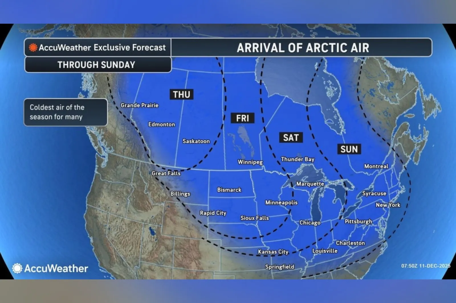
According to a forecast map from AccuWeather shared with Newsweek, states that could be impacted on Friday include Montana, North Dakota, South Dakota, Nebraska, and Minnesota.
On Saturday, the affected area will shift towards the Great Lakes area, with impacted states including Michigan, Illinois, and Indiana. The Northeast and Eastern U.S. will feel the chill on Sunday, the map showed.
This outbreak of frigid air, one of multiple recent icy blasts felt across parts of the U.S., is a result of a weakening of the polar vortex, according to the outlet.
According to the National Weather Service, the polar vortex is a broad region of low pressure and frigid air surrounding each of Earth’s poles. It is a year-round feature, though it weakens in summer and becomes more intense in winter. The word “vortex” refers to the counterclockwise circulation that helps confine this cold air near the poles. In many northern hemisphere winters, the polar vortex can stretch southward, allowing cold air to spill down with the jet stream. This is a fairly common winter pattern and is often linked to major Arctic cold outbreaks in the U.S., it says.
Next week, the Arctic outbreak is set to retreat, allowing temperatures to rebound and snow cover to shrink, AccuWeather said, adding that the harsh conditions are not expected to last through the holiday period.

...
Update, 12/12/25, 12:23 p.m. ET: This article was updated with comment from Bob Larson.
View 0 Comments
Submit Correction
View Editorial & AI Guidelines