Storm Prediction Center

By Joe Edwards
Reporter
0
Share
Newsweek is a Trust Project member
See more of our trusted coverage when you search.Prefer Newsweek on Googleto see more of our trusted coverage when you search.
The National Weather Service (NWS) Storm Prediction Center (SPC) is updating its forecast maps to better communicate the intensity of severe weather, introducing new visual tiers that clarify how dangerous storms may become.
The NOAA Storm Prediction Center (SPC) in Norman, Oklahoma, is the agency responsible for tracking and forecasting severe weather threats across the 48 contiguous United States.
In a video announcing the changes posted Friday to social media, warning coordination meteorologist Evan Bentley explained that the agency’s usual categories denoting the chance for severe weather—Marginal, Slight, Enhanced, Moderate and High—would not be changing.
Read More on News
Under this system, a Marginal risk means a few isolated severe storms are possible, while a Slight risk signals scattered severe storms, some briefly intense. Enhanced indicates numerous severe storms with a few stronger ones. Moderate means widespread, intense and longer‑lived severe storms are likely, and High reflects the potential for widespread, very intense and long‑duration severe weather.
...
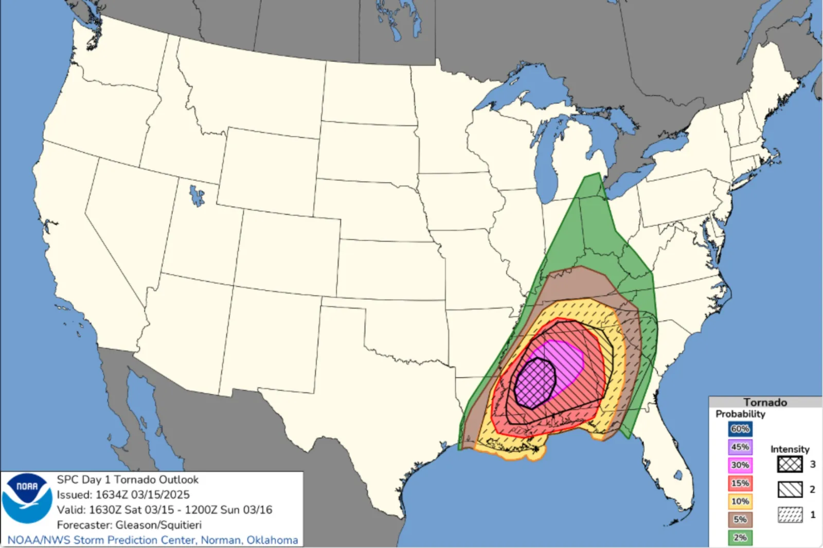
“What is changing is the black hatching,” Bentley said. “This is how we communicate storm intensity.”
Outlook forecaster Liz Leitman explained that the agency previously added “hatching” only when significant severe weather was expected to reach about 10 percent coverage or more—and that the symbol looked identical whether the threat involved an EF2 tornado or an extreme EF5.
Leitman said the revised maps introduce three new intensity tiers. Level 1 indicates that significant severe weather is possible. Level 2 signals a dangerous environment capable of producing intense tornadoes or very large hail. Level 3 is uncommon and reserved for historic outbreak-level intensity such as violent tornados or intense derechos.
“When no intensity area is present, we’re communicating that the vast majority of severe weather is expected to be lower-end severe,” Leitman added, explaining that the intensity risk can now be shown without the need for the 10 percent coverage requirement needed before.
“Instead of telling you ‘yes, there is a risk,’ we can tell you the risk [in a given area] is extreme,” Bentley said. “It separates the chance of seeing a storm from the power of that storm. It’s a smarter way to be prepared and stay safe.”
According to The Weather Channel, the outlook modifications have been under SPC experimentation since 2021, with the past four years building sufficient confidence for their public release and formal implementation.
Meanwhile, forecasters are warning that stretches of the U.S. could see multiple days of severe storms in the week ahead.
“Chances for damaging winds and hail, and tornadoes peak on Friday with an Enhanced Risk (level 3 out of 5), but all hazards look possible each day for the next week,” the NWS said on Wednesday.
In a polarized era, the center is dismissed as bland. At Newsweek, ours is different: The Courageous Center—it's not "both sides," it's sharp, challenging and alive with ideas. We follow facts, not factions. If that sounds like the kind of journalism you want to see thrive, we need you.
When you become a Newsweek Member, you support a mission to keep the center strong and vibrant. Members enjoy: Ad-free browsing, exclusive content and editor conversations. Help keep the center courageous. Join today.


View 0 Comments
Submit Correction
View Editorial & AI Guidelines