...

By Hollie Silverman
News Editor
0
Share
Newsweek is a Trust Project member
See more of our trusted coverage when you search.Prefer Newsweek on Googleto see more of our trusted coverage when you search.
The National Hurricane Center (NHC) announced new forecast graphics and services for the 2026 hurricane season, the agency said Monday.
The new features include the addition of inland watches and warnings to its operational track cone and introducing storm surge alerts for Hawaii, along with an experimental cone that uses ellipses to capture a wider range of forecast paths, also set to debut on Hurricanes.gov, according to the National Oceanic and Atmospheric Administration (NOAA).
Michael Brennan, director of NOAA’s National Hurricane Center, said in a press release that the changes aim to help communities prepare “earlier and more effectively” for hazards from tropical storms and hurricanes.
Read More on Weather
The Context
The updates revise one of the most widely viewed hurricane graphics in the U.S. and expand storm surge warnings to the Pacific’s most populous U.S. islands, changes that could affect evacuation planning and risk communication from the Gulf Coast to the Hawaiian Islands, according to the press release from NOAA.
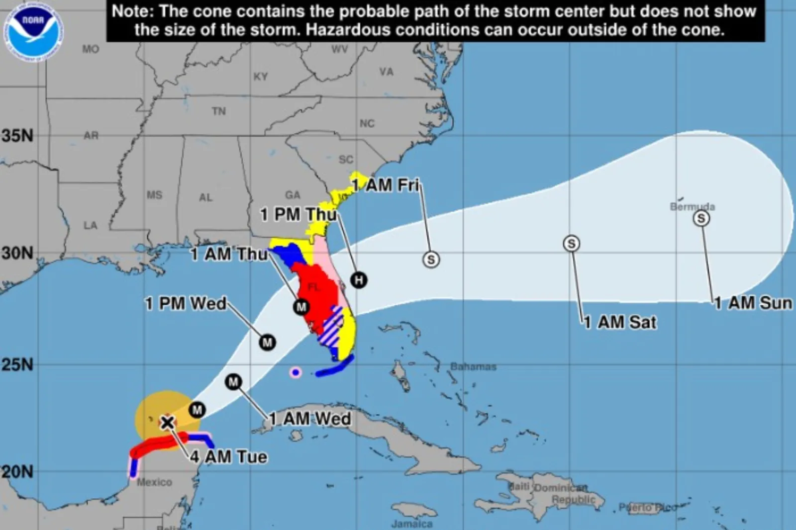
The operational cone will now display inland tropical storm and hurricane watches and warnings, addressing risks that often extend far from the coastline and have caused significant damage in recent seasons.
...
What To Know
Beginning in 2026, the NHC’s standard five-day forecast cone graphic will incorporate all land-based tropical storm and hurricane watches and warnings for the continental U.S., Hawaii, Puerto Rico, and the U.S. Virgin Islands, using single shading for the entire cone and legend symbols indicating overlapping watch and warning areas. Full and intermediate advisories will appear on Hurricanes.gov.
The NHC will test an experimental track cone that uses ellipses anchored at each forecast point to reflect uncertainty in both speed and direction, capturing 90 percent of forecast track possibilities instead of the traditional 67 percent.
The graphic will be available on Hurricanes.gov during full and intermediate advisories, and the agency cautioned that technical issues could affect timeliness during the experimental phase.
NHC Deputy Director Jamie Rhome said the experimental cone would be “about 23 percent wider” than the current cone and aimed to communicate a “most likely track,” addressing a tendency for the public to overinterpret certainty in previous versions, USA Today reported.
Local broadcast and weather outlets reported that the 2026 operational cone, which is based on recent forecast error trends, would be about 4–8 percent smaller than the 2025 cone in the Atlantic and 3–8 percent smaller in the Pacific, reflecting ongoing improvements in track forecasting, WCTV reported.
Hawaii Storm Surge Watches, Warnings, and Graphics
For the first time, the NHC will support storm surge watches and warnings and a peak storm surge graphic for the main Hawaiian Islands, expanding products already in place for the U.S. East and Gulf coasts, Puerto Rico, and the U.S. Virgin Islands.
The products deliver probability-based forecasts of water and surge levels within 72 hours of hurricane impacts and incorporate inputs such as forecast track, wind intensity, and wind radii, according to NOAA.
The NHC said all full and intermediate Tropical Cyclone Advisories and graphics would be publicly available on Hurricanes.gov, and noted that during the experimental phase, technical issues could affect the timeliness or availability of the new ellipse-based graphic.
What People Are Saying
Michael Brennan, director, NOAA’s National Hurricane Center, said in a press release Tuesday: “These improvements empower communities to prepare earlier and more effectively for dangerous hazards from tropical storms and hurricanes.”
Jamie Rhome, deputy director, National Hurricane Center, told USA Today Tuesday: “This would partially address the longstanding problem with the way people naturally viewed the cone, which was not in line with how it was created or formulated. They would assign a higher certainty than what the actual math provided.”
Alex DaSilva, lead hurricane forecaster for AccuWeather said Tuesday, as reported by USA Today: “We have full jurisdiction over the size of our cone and whether we want to make the width larger or one side bigger and the other side narrower. They (the NHC) could have really high confidence in the track but because their track is stuck, it has to be a specific size.”
What Happens Next
The NHC said the operational cone with inland alerts and the Hawaii storm surge products would roll out for the 2026 season beginning June 1, with the experimental ellipse-based cone available on Hurricanes.gov during advisories as testing proceeds.
The agency indicated that technical performance and public understanding would guide future refinements to the experimental graphic and any subsequent operational changes.
View 0 Comments
Submit Correction
View Editorial & AI Guidelines