NASA

By Joe Edwards
Reporter
0
Share
Newsweek is a Trust Project member
See more of our trusted coverage when you search.Prefer Newsweek on Googleto see more of our trusted coverage when you search.
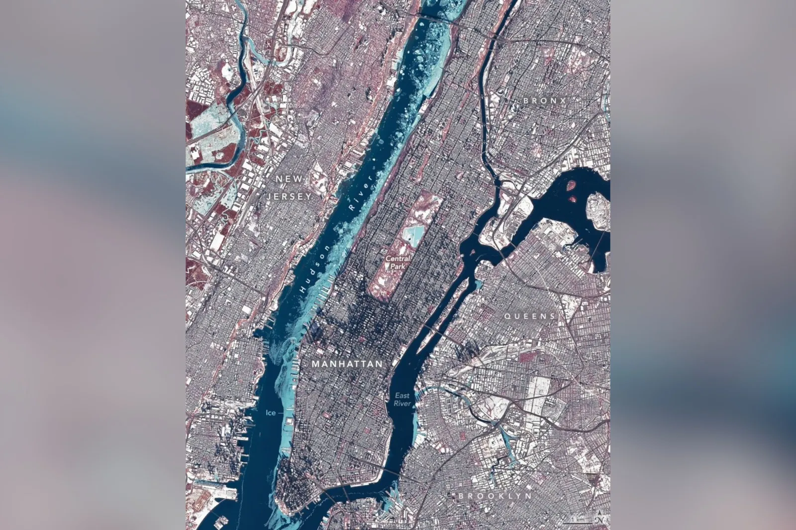
NASA released a false-color satellite image showing ice lining the Hudson River along Manhattan and appearing across other New York City waterways during a late-January cold spell, captured by the Operational Land Imager on Landsat 8 around midday on January 28, 2026.
The image, published as the Earth Observatory’s Image of the Day for February 4, 2026, depicted light-blue ice contrasting with darker open water and red-hued vegetation, illustrating the extent of the freeze’s impact on the region.
...
Read More on News
The ice formation underscored how a prolonged stretch of subfreezing temperatures can alter transportation, with NYC Ferry suspending services for several days due to ice buildup.
Landsat 8’s Operational Land Imager captured the New York metropolitan area in bands 5-4-3 false color, allowing ice (light blue) to be distinguished from open water and snow, with vegetation appearing red.
Ice choked the Hudson River along Manhattan’s western shore, with additional ice visible in the East River, the Jacqueline Kennedy Onassis Reservoir in Central Park, and waterways in New Jersey.
Temperatures in New York City dropped below freezing on January 24 and remained there for more than a week, with a high of 23 degrees Fahrenheit on January 28 amid a surge of Arctic air affecting much of eastern North America, NASA said.
Much of the Hudson River ice near Manhattan likely floated from farther upriver, where weaker tidal currents and lower salinity allow water to freeze sooner and at higher temperatures than the faster-flowing water near the river’s mouth, making a complete freeze around Manhattan unlikely though it occurred in 1888, the agency explained.
Beyond the waterways, winter conditions included nearly 12 inches of snow recorded in Central Park on January 25, long building shadows cast by the low midwinter sun—as well as a folklore nod as Staten Island Chuck’s shadow was observed on February 2—with a National Weather Service outlook calling for below-average temperatures to persist and Arctic air to return by the weekend, NASA said.
The National Weather Service forecast office for the New York area said Tuesday that a winter weather advisory had been issued for the Lower Hudson Valley as well as parts of southern Connecticut until 6 a.m. Wednesday morning, with a wintry mix expected to bring “minor” snow accumulation, though a glaze of ice “will make travelling hazardous, especially on any untreated surfaces.”
View 0 Comments
Submit Correction
View Editorial & AI Guidelines