
AccuWeather

By Joe Edwards
Reporter
0
Share
Newsweek is a Trust Project member
See more of our trusted coverage when you search.Prefer Newsweek on Googleto see more of our trusted coverage when you search.
Millions of Americans could see severe weather this week, including heavy rain and thunderstorms, as a pair of storms is expected to sweep across parts of the U.S., according to forecasters.
"There is a multi-day risk for severe weather that begins today that will span through Saturday across the central, southern and eastern United States," AccuWeather meteorologist Brandon Buckingham told Newsweek on Thursday. "These risks will stem from two separate storm systems as they quickly track out of the southwestern United States towards the Great Lakes and Canada. Both of the passing storms are funneling relatively warm and humid air very far north by January standards, bringing the risk for thunderstorm activity into places like Chicago and Detroit."
A storm is expected to take shape over Texas on Thursday before pushing toward the Great Lakes by early Friday. As it intensifies, it will unleash a wide swath of precipitation—with snow and ice across northern areas and heavy rain and thunderstorms farther south—affecting many states on the eastern side of the Rockies, according to AccuWeather forecasters.
Read More on News
A forecast map from AccuWeather shared with Newsweek on Wednesday showed that states facing potential severe thunderstorms on Thursday included northeast Texas, northwest Louisiana, eastern Oklahoma, much of Arkansas, western Tennessee, southern Missouri and western Kentucky.

...
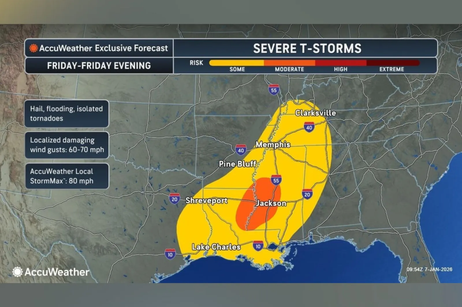
On Friday, areas facing the highest risk of severe thunderstorms include northeast Louisiana and southwestern Mississippi, according to another forecast map.
...
"This storm will pack a punch as it strengthens and moves across the country. Several inches of snow and pockets of sleet and freezing rain are expected on the northern side of the storm. Downpours and thunderstorms are likely along the southern side of the storm, from the Gulf Coast of Texas to New England," Buckingham said in an advisory.
"Heavy rainfall from northeast Louisiana through southern Kentucky and into parts of western Virginia may trigger flash flooding on Friday. The rain will be beneficial in some areas dealing with abnormally dry or drought conditions."
Buckingham added: "Severe weather is possible toward the end of the week along the southern side of the cross-country storm. Severe thunderstorms on Thursday could produce hail and damaging wind gusts. The severe weather threat is expected to intensify on Friday from eastern Louisiana and Arkansas into central Mississippi. Severe thunderstorms could be capable of producing damaging wind gusts, hail, and even a few tornadoes."

...
The outlet also said downpours could trigger flash flooding in cities and spots with poor drainage, including in northeast Louisiana and western Mississippi up through south‑central Kentucky, from Friday into the weekend as another storm system forms. Snow and ice developing along the storm's northern edge are likely to worsen travel on major highways and disrupt airports across parts of the Midwest and East Coast, it said.
According to AccuWeather, colder air is set to return to the Great Lakes and the eastern U.S. as the system moves out late in the weekend. Increasing winds may flip lingering rain over to accumulating snow and spark a burst of lake‑effect snow, extending travel disruptions, it added.
"Saturday will continue to feature a risk for thunderstorms, with the corridor of risk shifting eastward into portions of the Southeast and mid-Atlantic states," Buckingham told Newsweek. "Atlanta, Charlotte, North Carolina and Roanoke Virginia are a few of the cities within the risk zone. Primary concerns from Saturday’s severe risk include locally damaging wind gusts and hail."
Update 01/08/25, 12:16 p.m. ET: This article was updated with comment from Brandon Buckingham.
View 0 Comments
Submit Correction
View Editorial & AI Guidelines