
By Joe Edwards
Reporter
0
Share
Newsweek is a Trust Project member
See more of our trusted coverage when you search.Prefer Newsweek on Googleto see more of our trusted coverage when you search.
Several states in the Northeast are facing heavy snow on Wednesday as a "strong" clipper system is expected to move across the region, according to meteorologists.
The National Weather Service (NWS) said the system was expected to bring heavy snow and high winds to the upper Midwest on Tuesday, then across the Great Lakes area on Wednesday.
"Snowfall amounts of four to eight inches can still be expected from northeastern corner of North Dakota through the central Great Lakes," the agency said. "This clipper system is forecast to quickly intensify, producing an expanding area of very strong and gusty winds to accompany the snow."
Read More on News
The "maturing" clipper would move into the lower Great Lakes by Wednesday morning, "spreading wintry weather into the Interior Northeast," it said.
...
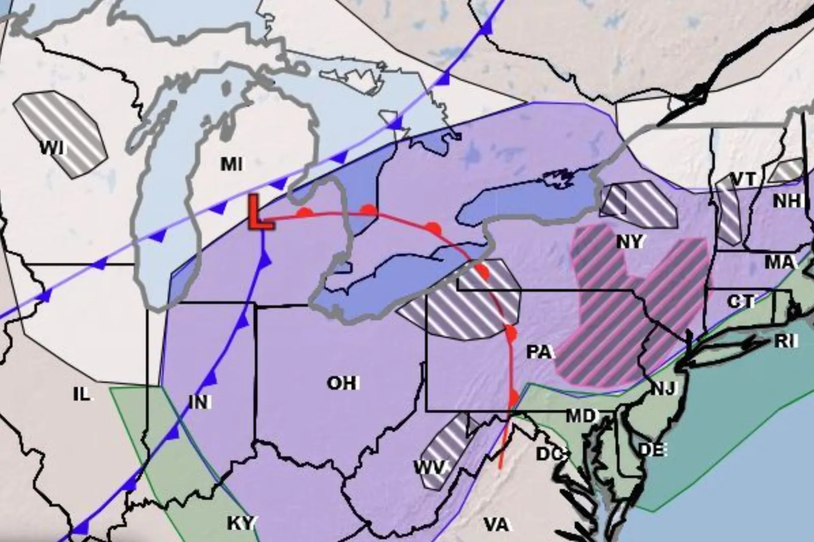
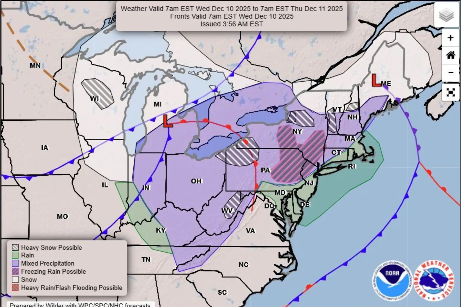
A forecast map from the agency showed that areas potentially facing heavy snow on Wednesday include northeastern Ohio and northwest Pennsylvania, parts of Upstate New York, and portions of Vermont and New Hampshire.
"Currently, a powerful clipper is sweeping through the Midwest and into the Northeast, bringing a mixture of rain and snow across the regions. Also accompanying the storm are powerful wind gusts that are sweeping in on the back side of the storm across the Plains, Midwest and the Northeast," AccuWeather meteorologist Brandon Buckingham told Newsweek on Wednesday morning.
The highest snowfall totals from this system are expected to focus across Wisconsin and central Michigan, along with northern New York near the Adirondacks where six to 12 inches of snow is expected, Buckingham said.
"Additional snow is expected behind this clipper in the form of lake effect snow between Wednesday night and Thursday night in the favored lake effect belt zones of Michigan, Pennsylvania, New York and the high terrain of West Virginia," said Buckingham.
According to the meteorologist, six to 12 inches of additional accumulation is expected from just the lake effect snow within the most intense and persistent bands.
The NWS explains that lake effect snow—a common occurrence across the Great Lakes region in late fall and winter— forms when cold air masses move over the open waters of the Great Lakes.
"The next clipper will be quickly following behind the lake effect snow as it tapers off. By Thursday, a swath of ice and snow can track across the northern and central Plains into the Midwest, bringing along hazardous travel conditions," Buckingham told Newsweek.
"This clipper is not expected to be as intense as the current storm, but it can still produce a narrow strip of three to six inches of snow with locally higher amounts from southern Minnesota to central Indiana by the end of the day on Friday."
Yet another storm will start out in Montana Thursday and Friday, race across the Plains and Midwest by Saturday, and likely head toward the East Coast Saturday night into Sunday.
It could intensify as cold air meets the Atlantic, bringing a brief shot of snow from the mid-Atlantic to New England later this weekend, though the forecast is still uncertain at this time, said Buckingham.
View 0 Comments
Submit Correction
View Editorial & AI Guidelines