...

By Joe Edwards
Reporter
0
Share
Newsweek is a Trust Project member
See more of our trusted coverage when you search.Prefer Newsweek on Googleto see more of our trusted coverage when you search.
A prolonged stretch of severe weather is forecast to impact the central United States throughout the week, according to AccuWeather forecasters.
Why It Matters
Meteorologists are anticipating potential hazards to include hail, downpours and even isolated tornados, as well as damaging wind gusts up to 70 miles per hour (mph) at times.
Read More on News
This follows warnings from the National Weather Service's (NWS) Storm Prediction Center (SPC) that a portion of the upper Midwest faced the threat of severe thunderstorms and tornadoes on Monday, particularly parts of Minnesota, Iowa, and Wisconsin.
What To Know
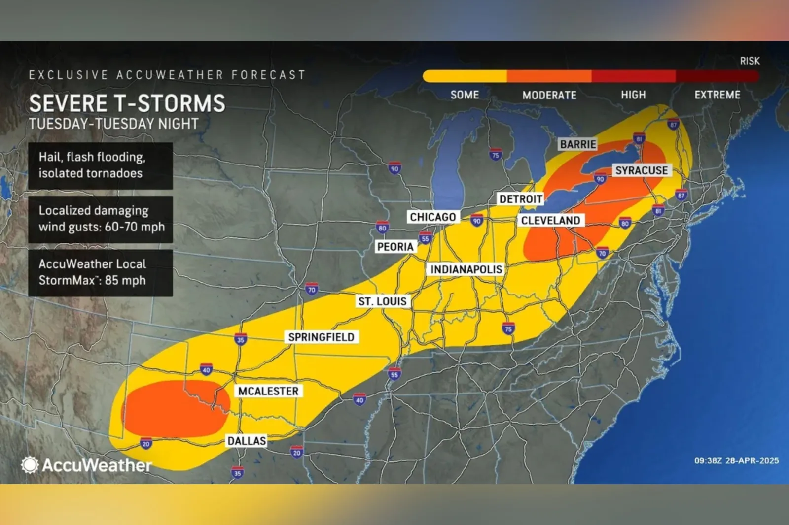
The threat of severe weather will shift eastward on Tuesday, stretching from northern Texas through New York, New England, and southern Ontario.
Thunderstorms may bring hail, flash flooding, localized damaging wind gusts, and even isolated tornadoes, AccuWeather said.
...
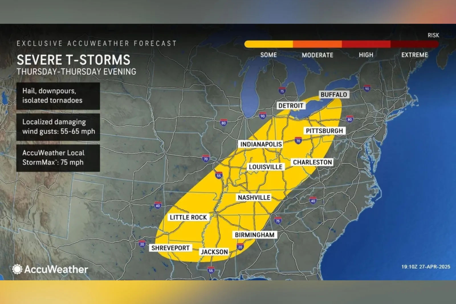
The threat of severe thunderstorms will persist through Wednesday and Thursday. Regions from Texas northward into Oklahoma, and east into parts of Arkansas and Louisiana, will face a heightened risk for strong storms, according to the forecast.

...
By Thursday, the severe weather threat is forecast to shift eastward toward the Tennessee and Ohio River valleys.
AccuWeather said residents and businesses in the region, especially in high-risk areas, should have a plan in place should a tornado warning be issued, especially after dark.
...
What People Are Saying
The National Weather Service (NWS) wrote on X, formerly Twitter, on Monday: "Multiple corridors of severe thunderstorms are expected across the Upper Midwest later today into tonight (April 28), with a regional severe weather outbreak possible. The most dangerous period is likely during the late afternoon and evening when strong tornado potential should be maximized. Scattered large to very large hail and damaging winds are likely as well."
AccuWeather meteorologist Elizabeth Danco said on Monday: "Some of the tornadoes expected to spawn later Monday can be long-lived. This will pose a serious risk, particularly with those that develop after dark when they are more difficult to detect and prepare for."
AccuWeather meteorologist Alexander Duffus said on Monday: "Strong thunderstorms will be enhanced by a fast-moving jet stream. That will lend support for the potential of a few intense tornadoes across the region."
The NWS Storm Prediction Center wrote on X on Monday: "Scattered severe storms with very large hail and a few tornadoes are possible this afternoon into early tonight from northwest Texas into the western half of Oklahoma."
What Happens Next
AccuWeather said the threat of damaging storms will decrease in early May, with only a few gusty and heavy rain-producing storms expected to move toward the East Coast by Friday.
Forecasts are sometimes subject to change, with organizations such as the NWS, issuing regular forecast updates.
View 0 Comments
Submit Correction
View Editorial & AI Guidelines