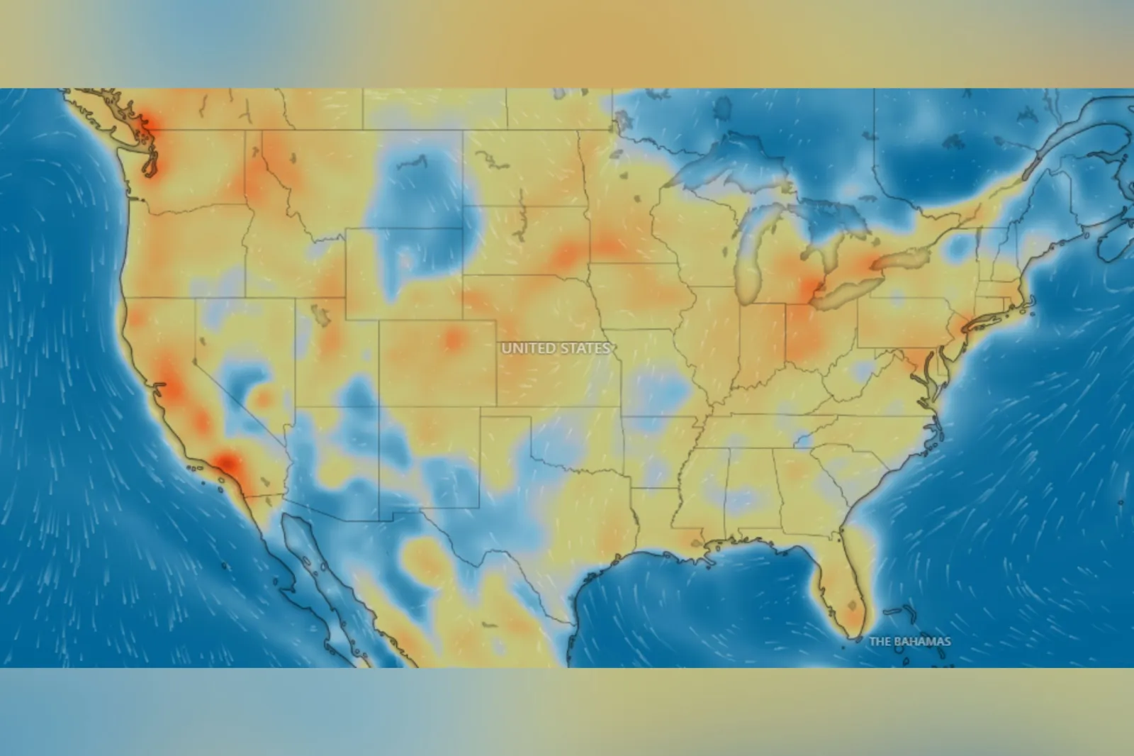
Windy.com/windy map screenshot for thumbnail

By Joe Edwards
Reporter
0
Share
Newsweek is a Trust Project member
See more of our trusted coverage when you search.Prefer Newsweek on Googleto see more of our trusted coverage when you search.
A series of live maps from Windy.com highlighted which parts of the U.S. were experiencing elevated levels of air pollution on Friday.
The maps showed data for multiple types of pollutant, including nitrogen dioxide (NO₂), particles (PM2.5), surface ozone, sulfur dioxide (SO₂), carbon monoxide (CO) concentration, aerosol, and dust mass.
Nitrogen Dioxide (NO₂)
According to the Environmental Protection Agency (EPA) nitrogen dioxide (NO₂) belongs to a group of highly reactive gases collectively known as nitrogen oxides (NOₓ), which also include compounds like nitrous acid and nitric acid. NO₂ is commonly used as a representative indicator for this broader category of nitrogen oxides.
Read More on News
The main source of NO₂ in the atmosphere is fuel combustion, the EPA says. It is produced by emissions from vehicles such as cars, trucks, and buses, as well as from power plants and off-road machinery.
The agency warns that breathing high levels of nitrogen dioxide (NO₂) can irritate the respiratory system and worsen conditions like asthma, causing symptoms such as coughing, wheezing, and difficulty breathing. Short-term exposure may lead to emergency room visits, while long-term exposure can contribute to asthma development and increase vulnerability to respiratory infections. Children, the elderly, and people with asthma are especially at risk.
According to a live map from Windy.com, areas with some of the highest NO₂ concentrations as of early Friday included New York, Los Angeles, and Detroit.
Particles (PM2.5)
The CDC says that particulate matter is made up of minuscule pieces of solids or liquids in the air, including dust, soot, dirt, smoke, or drops of liquid.
Smaller particles, known as PM2.5, are particularly dangerous as they can penetrate deep into the lungs or even enter the bloodstream, the agency says.
This type of pollution poses the greatest risk to older adults, young children, and individuals with preexisting medical conditions.
Windy.com's map showed heightened PM2.5 levels across parts of California, Nevada, Arizona, North and South Dakota, Pennsylvania, Maryland, and New York at the time of writing.
Surface Ozone
"Ozone is a secondary pollutant, meaning it's not emitted directly from sources, but is formed through chemical reactions," AccuWeather meteorologist Brandon Buckingham told Newsweek. "These reactions require sunlight and higher temperatures, making warmer months more prone to ozone formation. When air is stagnant, pollutants don't get dispersed, allowing ozone to build up to unhealthy levels."
The Environmental Protection Agency (EPA) cautions that exposure to ozone may irritate the respiratory tract, cause airway inflammation, and aggravate existing conditions like asthma, emphysema, and chronic bronchitis.
According to Windy.com's map, the highest concentration of ozone was located in California, east of Barstow on Friday morning.
Sulfur Dioxide (SO₂)
According to the EPA, the primary contributor of sulfur dioxide (SO₂) in the atmosphere is the combustion of fossil fuels by power plants and various industrial operations. Additional, smaller sources of SO₂ emissions include industrial activities like metal extraction from ore, natural phenomena such as volcanic eruptions, and the use of fuel with high sulfur content in locomotives, ships, and other heavy-duty vehicles and equipment.
The agency says that short-term exposure to sulfur dioxide (SO₂) can negatively impact the respiratory system and cause difficulty in breathing. Individuals with asthma—especially children—are particularly vulnerable to these effects.
When SO₂ emissions reach elevated levels, they can contribute to the formation of additional sulfur oxides. These compounds can interact with other substances in the atmosphere, resulting in the creation of small particles. These tiny particles can penetrate deep into the lungs and, when present in large enough quantities, may lead to health issues, the EPA says.
Windy.com's map showed that the highest levels of SO₂ were in Pennsylvania, West Virginia, Ohio, Kentucky, and Indiana on Friday morning.
Carbon Monoxide (CO) Concentration
Carbon monoxide (CO) is a colorless, odorless gas that becomes harmful at high levels, the EPA says. It is produced by burning and mainly enters outdoor air through vehicles and machinery that use fossil fuels.
Breathing high levels of CO reduces the blood's ability to carry oxygen to vital organs like the heart and brain. Very high concentrations—usually indoors—can cause dizziness, confusion, unconsciousness, or even death.
Outdoors, the EPA says elevated CO levels can pose risks for people with heart disease, potentially triggering chest pain (angina) during physical exertion or stress and reduced oxygen to the heart.
According to Windy.com's map, the highest CO levels were along the East and West Coasts, as well as the Midwest.
Aerosol
The CDC defines aerosol as a suspension of particles or droplets in air. This may include airborne dusts, mists, fumes, or smoke.
Aerosol levels were slightly heightened in Iowa, North Dakota, New York, Connecticut, and Massachusetts on Friday morning.
Dust Mass
The CDC warns that dust from roads, farms, dry riverbeds, construction sites, and mines can irritate the eyes, nose, and throat.
Several states showed elevated levels on Friday morning, including, but not limited to, parts of:
- California
- Nevada
- Arizona
- Utah
- Idaho
- Wyoming
- Kansas
View 0 Comments
Submit Correction
View Editorial & AI Guidelines