Windy.com/Drought map for thumbnail

By Joe Edwards
Reporter
0
Share
Newsweek is a Trust Project member
See more of our trusted coverage when you search.Prefer Newsweek on Googleto see more of our trusted coverage when you search.
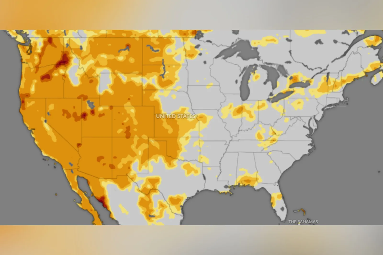
A live map from Windy.com highlighted which parts of the United States were experiencing the most pronounced drought conditions as of Friday.
Why It Matters
Drought can have serious implications for water supply. In 2022, Lake Mead—the largest reservoir in the U.S. by capacity—fell to critically low levels following years of drought.
Read More on News
What To Know
According to a map of drought conditions from Windy.com, the areas experiencing the most intense drought conditions as of Friday morning included parts of Utah, Arizona, Nevada, California, Colorado, Oregon, Washington, and Montana.
In Arizona and Nevada, this included the area just south of Lake Mead.
Drought conditions were most widespread in the western U.S., although pockets of mild to severe drought intensity were scattered throughout the rest of the country, Windy.com's map showed.
According to the latest update from the U.S. Drought Monitor, drought conditions continued to ease across the Great Plains due to heavy rainfall. However, long-term drought persists in south-central Texas.
Improvements were seen in parts of New Mexico, southwestern Colorado, and Arizona, while drought worsened in the Pacific Northwest and Northern Intermountain West.
Most of the Corn Belt and Midwest remain drought-free, except for northern Illinois where conditions worsened, the agency said.
Central to southwestern Florida saw drought end after heavy storms. The East, Ohio and Tennessee Valleys, and Lower Mississippi Valley are mostly drought-free, U.S. Drought Monitor said.
Jay Lund, a professor of civil and environmental engineering at the University of California, Davis, told Newsweek that climate change is making droughts in the U.S. harder in several ways. Higher temperatures increase evaporation from land and plants, reducing how much water reaches streams, reservoirs, and groundwater.
Warmer temperatures cause snow to melt earlier or fall as rain, shifting streamflow to winter when it's less useful and harder to manage, Lund said.
"There is some thought that more precipitation is happening in few storm events, which makes it hard to capture runoff from these events for use in drier times," he added.
What People Are Saying
Jay Lund, a professor of civil and environmental engineering at the University of California, Davis, told Newsweek: "Perhaps the biggest aspect of these climate changes for the west is that they have exacerbated long-standing groundwater overdraft and overdraft of the huge Colorado River reservoirs, making these problems worsen at a broadly unacceptable rate. This is accelerating management discussions and changes that would have been even more strongly resisted otherwise."
He continued: "The biggest vulnerabilities are to ecosystems and agriculture. Ecosystems are already on the ropes, and now must contend with higher temperatures, the new invasive species these bring, and worsening droughts. Agriculture, as the major water use in the West with low economic values for water will likely have to give up 10-20 percent of its least valuable irrigated acreage, which will harm many rural areas. Urban areas need relatively little water and have resources and expertise to manage—it will be more expensive, but manageably so if well led, except for some marginal communities."
What Happens Next?
The U.S. Drought monitor issues weekly updates regarding drought conditions in the U.S.
View 0 Comments
Submit Correction
View Editorial & AI Guidelines