...

By Sam Stevenson
Associate News Editor
0
Share
Newsweek is a Trust Project member
See more of our trusted coverage when you search.Prefer Newsweek on Googleto see more of our trusted coverage when you search.
A search and rescue operation has been launched after an Indonesia Air Transport (IAT) ATR 42-500 aircraft suddenly vanished off radar on Saturday, according to Indonesian news agency ANTARA.
Indonesian search and rescue (SAR) agency Basarnas has confirmed that 11 people were on board the plane, which is feared to have crashed in Maros District, South Sulawesi.
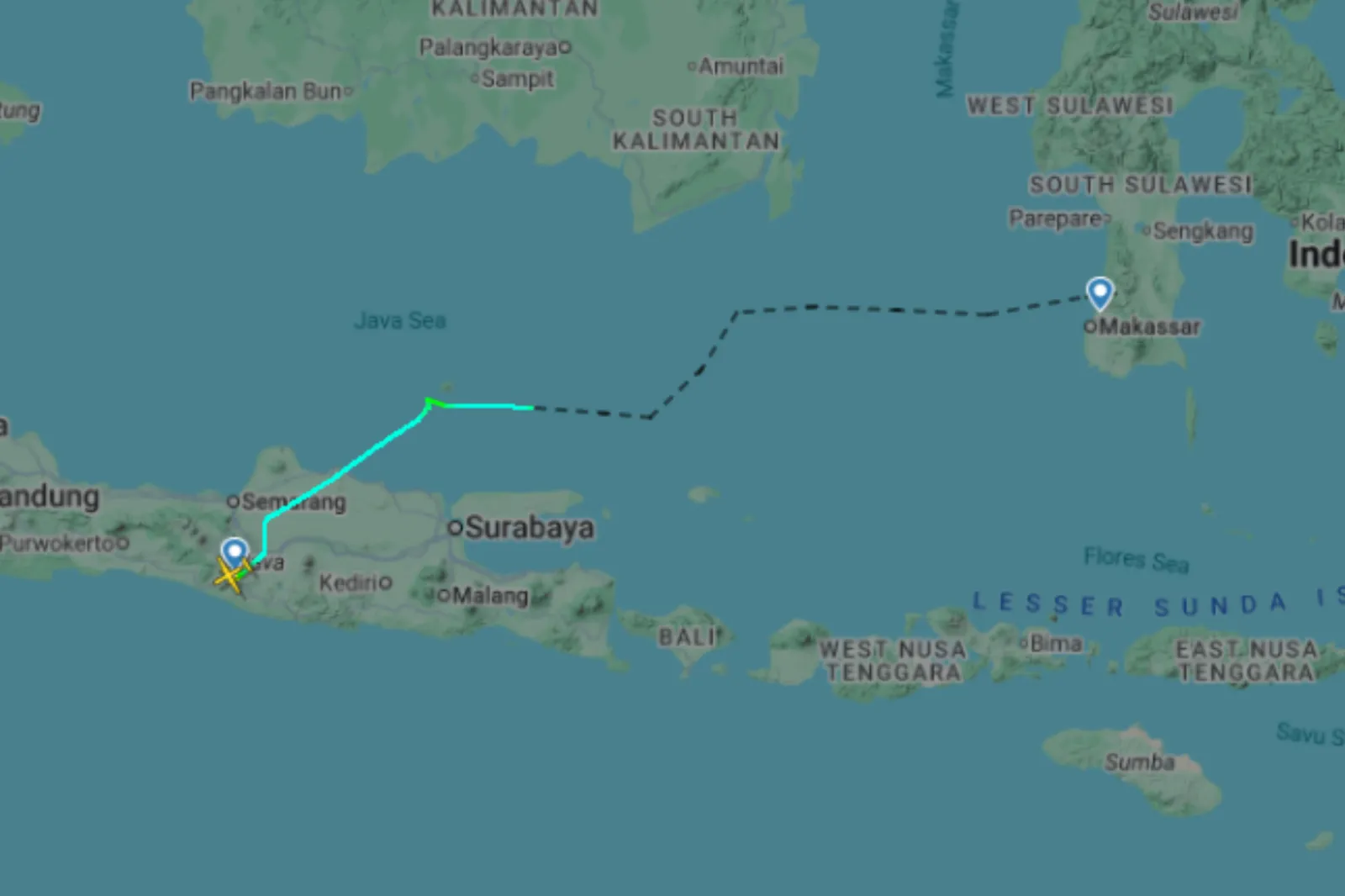
Edy Prakoso, operations director at Basarnas, said the aircraft vanished while flying from Yogyakarta to Makassar, the capital of South Sulawesi, ANTARA reported.
Read More on News
"The aircraft was carrying 11 people—eight crew members and three passengers. Its last contact was at 1:17 p.m. local time," he said.
Confirming coordinate data from Indonesia's air navigation service provider, AirNav Indonesia, he said the plane’s last recorded position was at coordinates 04°57’08” S and 119°42’54” E, near the Leang-Leang area in the mountainous Maros District.
Prakoso added that the Makassar SAR office immediately deployed search teams after receiving the AirNav Indonesia report, sending 25 officers who were split into three groups to look for the missing aircraft.
"The personnel are on their way to the last identified point in Leang-Leang," he said.
Data from the flight tracking website FlightRadar shows the plane, registration PK-THT, was flying over the ocean at low altitude when it last received a signal at 4:20 a.m. UTC (11 p.m. ET), about 20 km northeast of Makassar Airport.
Andi Sultan, head of operations at the Basarnas Makassar office, said drones and a helicopter had been deployed in the search for the plane, ABC News Australia reported, citing AFP.
"We are currently heading to the location after being provided with coordinate points from AirNav, around the Leang-Leang area in Maros Regency," Sultan is reported as saying.
Unverified footage posted on social media appeared to show debris from the plane at the foot of Mount Bulusaraung, Pangkep, according to local media.
Maros District is a rugged, mountainous area of South Sulawesi known for its steep limestone cliffs, dense forests and deep valleys. The terrain is remote and difficult to navigate, which often complicates search and rescue operations in the region.
Indonesia, a sprawling archipelago that depends heavily on air travel to link its many islands, has long struggled with aviation safety. The country has recorded several deadly crashes in recent years.
In September, a helicopter carrying six passengers and two crew members went down shortly after taking off from South Kalimantan province, killing everyone on board. Less than two weeks later, another helicopter crashed in the remote Papua district of Ilaga, leaving four people dead.
Update 1/17/26, 8:09 a.m. ET. This article has been updated with more information.
View 0 Comments
Submit Correction
View Editorial & AI Guidelines