
10
Loading video...

By Joe Edwards
Reporter
0
Share
Newsweek is a Trust Project member
See more of our trusted coverage when you search.Prefer Newsweek on Googleto see more of our trusted coverage when you search.
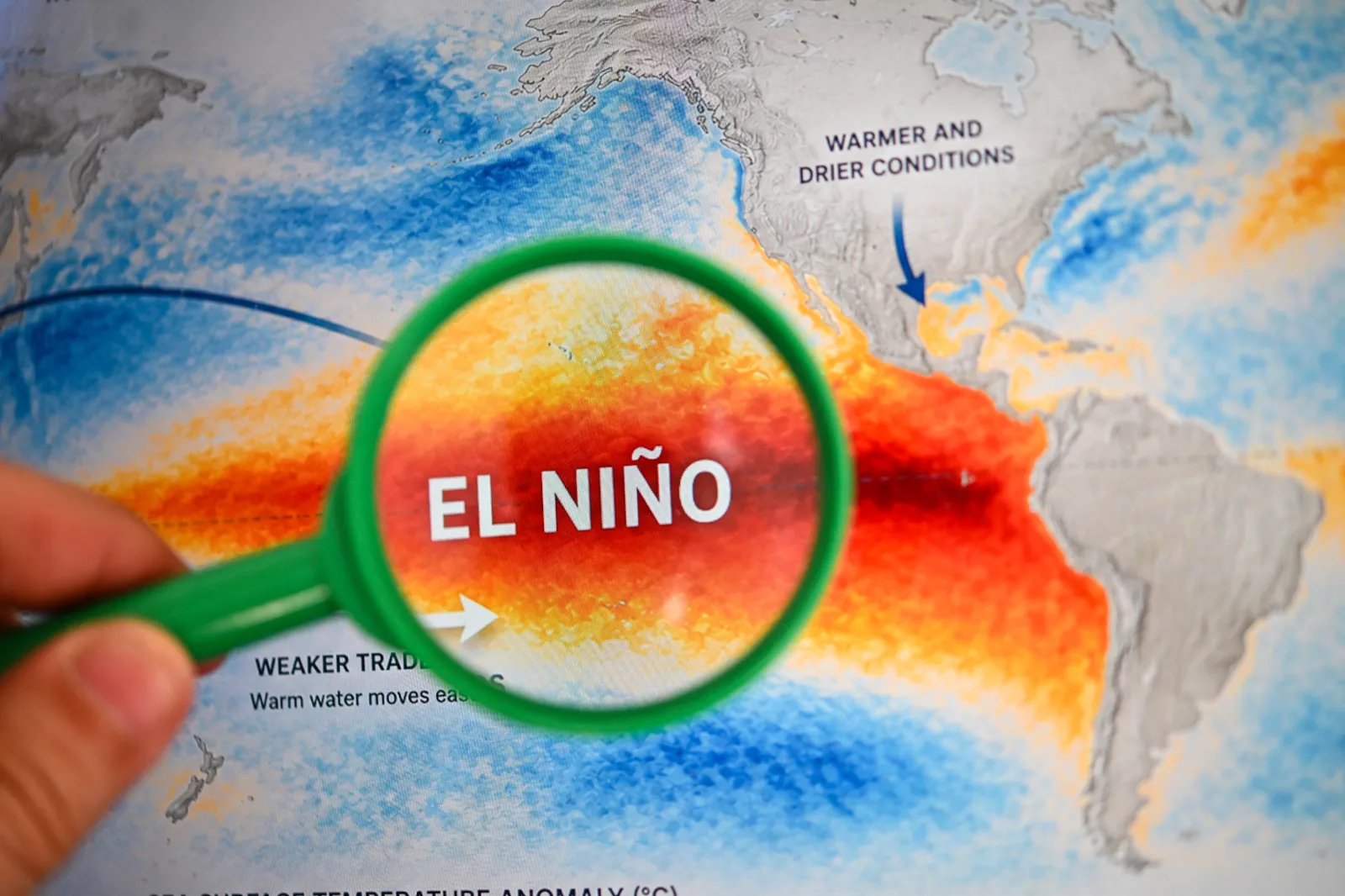
El Niño is strengthening across the tropical Pacific, with forecasters warning that the climate pattern could reach exceptional intensity and influence weather through the winter and into 2027.
The National Oceanic and Atmospheric Administration’s (NOAA) Climate Prediction Center gives a greater than 90 percent chance of a very strong event during fall and winter, while the World Meteorological Organization (WMO) says El Niño is expected to reach very strong intensity before peaking near the end of 2026. AccuWeather says it is increasingly likely to become the strongest El Niño since at least 1950.
What Is El Niño?
El Niño is the warm phase of the El Niño-Southern Oscillation, or ENSO, a recurring Pacific climate pattern that can affect weather worldwide. Its counterpart, La Niña, is the cool phase of the cycle.
Read More on Weather
Typical El Niño effects can include stormier weather across the Southern U.S., drier conditions in some northern areas and changes in hurricane activity.
"Super El Niño" is not a formal NOAA classification. It is commonly used to describe an exceptionally strong event.
...
"Over the next few months, the public should watch to see if El Niño continues to strengthen. El Niño is measured in the ENSO 3.4 region which is a designated area in the Eastern Pacific where sea-surface temperatures are compared to climatology," AccuWeather meteorologist Alex DaSilva told Newsweek.
"If we see a record El Niño, there is a very high likelihood that global temperatures in 2027 will be the warmest on record."
NOAA Climate Prediction Center
In its August 13 discussion, NOAA’s Climate Prediction Center said El Niño was expected to continue strengthening through the end of 2026. It gave a greater than 90 percent chance of a very strong event during the Northern Hemisphere fall and winter of 2026-27.
For the October-to-December period, NOAA gave a 69 percent chance of a "historic" event that would exceed the strength of all previous El Niños dating back to 1950.
NOAA cautioned that an event of this magnitude would increase the chances of El Niño-consistent effects, but said those effects were not guaranteed.
World Meteorological Organization
The WMO said Thursday that El Niño was firmly established and expected to intensify into a very strong event in the coming months. Forecasts from its Global Producing Centres showed a nearly 100 percent likelihood that El Niño would persist through February 2027, it said.
The organization said exceptionally warm conditions across the tropical Pacific supported further strengthening, with El Niño expected to peak toward the end of 2026 and its climate effects to continue well into 2027. It also warned of potential changes in rainfall and temperature patterns, accompanied by risks of floods, drought and extreme heat.
For September through November, WMO multi-model forecasts indicated an increased likelihood of above-normal temperatures across almost all land areas. However, the organization stressed that El Niño’s strength alone does not determine the severity of its effects in a particular country or region. Impacts vary by season and location and can be altered by other climate drivers, it said.
AccuWeather
Private weather company AccuWeather said its hurricane experts had very high confidence that "Super El Niño" conditions would develop during the second half of the Atlantic hurricane season. It said the 2026-27 event was increasingly likely to become the strongest since at least 1950.
"It really does not matter whether this is a record or Very Strong El Niño. It is about the impacts, and the impacts will not change either way," AccuWeather Lead Long-Range Meteorologist Paul Pastelok said. "We are seeing a strong impact in both the Atlantic and Pacific basins, with extreme wind shear limiting Atlantic storm development, while the Pacific remains quite active as we expected back in the spring."
For the U.S., AccuWeather forecast an active southern storm track and above-average temperatures in parts of the northern tier during fall. It also warned that "extreme and exceptional" drought conditions are expected to persist in parts of the West.
"The current El Niño is the strongest on record to date if you take the daily value. In other words, reliable ENSO records have been kept (since 1950) there has never been an El Niño stronger on this date than the current one," DaSilva told Newsweek. "El Niño typically peaks in the northern hemisphere winter so it looks like this El Niño will continue to strengthen over the coming months and has a good chance to be the strongest ever on record.
"While the daily value is in record territory, for this to be declared the strongest El Niño on record, you would need the El Niño to strengthen and sustain itself for several months in a row."
Contact Newsweek editors on this story: John Fitzpatrick and James Debens
View 0 Comments
Submit Correction
View Editorial & AI Guidelines