
...


By Joe Edwards and Anna Skinner
0
Share
Newsweek is a Trust Project member
See more of our trusted coverage when you search.Prefer Newsweek on Googleto see more of our trusted coverage when you search.
El Niño is likely to develop in the coming months and may strengthen into a rare "super" event, with implications for rainfall in the U.S. and impacts to the Atlantic hurricane season, according to forecasters.
A potential super El Niño could influence heat waves, hurricane activity and rainfall patterns across large parts of the globe this summer. El Niño, marked by warming Pacific waters, and La Niña, its cooling counterpart, are phases of the El Niño-Southern Oscillation, a major influence on global weather.
Chances of a Super El Niño As Summer 2026 Approaches
NOAA's Climate Prediction Center said earlier this month there was a 61 percent chance El Niño would emerge between May and July and continue through at least late 2026. On Tuesday, AccuWeather Lead Hurricane Expert Alex DaSilva told Newsweek that odds of a super El Niño have increased slightly over the past few weeks.
Read More on Weather
“We’re currently forecasting a 15 to 20 percent chance of a Super El Niño developing by the end of the hurricane season," he said, which is trending higher than the 15 percent chance previously predicted on April 10.
Forecasters generally define a super El Niño as water temperatures being at least 2 degrees Celsius warmer than average over several months.
“A Super El Niño is relatively rare. If it happens, it would be only the second since 2000. The 1997 event is one of the strongest on record, and it would take a lot for this one to rival that," DaSilva told Newsweek.
What a Super El Niño Could Mean for Summer Weather
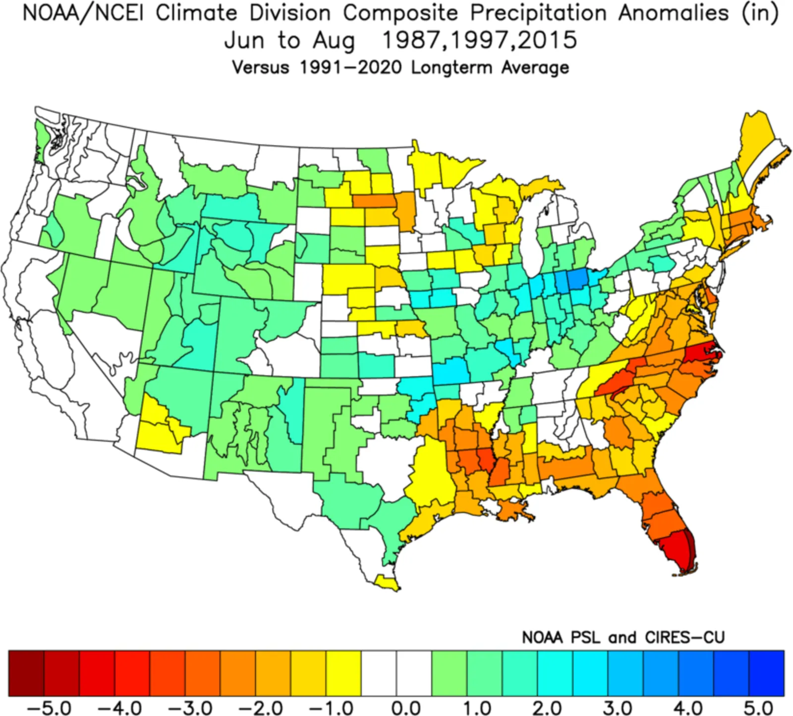
Some of the biggest impacts on U.S. summer weather will come in the form of rain.
"In the U.S., an El Niño pattern typically brings more rain to the Midwest and parts of the West during the summer," AccuWeather senior meteorologist Chad Merrill said in a report.
"It will likely produce extended periods of dry weather from the Gulf Coast to the East Coast but mixed in will be some heavy pockets of rain," he continued.
...
According to AccuWeather, the Midwest and Mississippi Valley will likely be among the wetter regions this summer. Merrill said rainfall "will likely be meaningful" in the Corn Belt, while the Midwest will have a "much lower" drought risk.
Washington Post meteorologist and writer Ben Noll outlined earlier in April several El Niño-related weather impacts anticipated to occur globally through at least October. These include the following:
- Central and northern India could face drought, with weaker monsoon rainfall potentially affecting agricultural production.
- The western U.S. may experience hotter, more humid summer temperatures, with occasional heavy downpours possibly reaching the Plains and extending severe thunderstorm season.
- Droughts may develop across parts of Central Africa, Australia, Indonesia, the Philippines, Central America and northern Brazil later in the year.
- Heat waves are expected to occur more frequently across large areas of South America, the southern U.S., Africa, Europe, parts of the Middle East, India and eventually Australia.
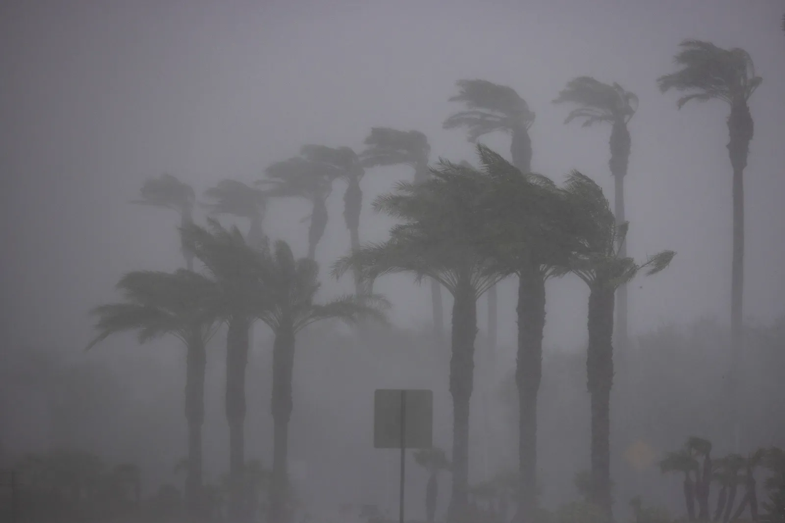
El Niño can also have an impact on the hurricane season, which in the Atlantic usually runs from June 1 to November 30.
"El Niño conditions are associated with fewer tropical storms and hurricanes, especially in the western Atlantic Ocean Basin," Matthew Rosencrans, NOAA's lead for its seasonal hurricane outlook, told Newsweek. "El Niño conditions are associated with more tropical storm and hurricane activity during the eastern and central Pacific hurricane seasons."
...
El Niño and La Niña: Explained
El Niño and La Niña are opposite phases of a naturally recurring climate cycle in the tropical Pacific known as the El Niño–Southern Oscillation (ENSO). The system shifts irregularly every two to seven years, changing ocean temperatures and disrupting normal wind and rainfall patterns across the tropics.
During La Niña, stronger‑than‑usual trade winds push warm surface waters west toward Asia. This allows cooler, nutrient‑rich water to rise along the western coasts of the Americas. The cooler Pacific waters push the jet stream north, often bringing drought to the southern U.S. while increasing the risk of heavy rain and flooding in the Pacific Northwest and Canada. Winters tend to be warmer in the South and colder in the North, and La Niña can also contribute to a more active Atlantic hurricane season.
El Niño produces the opposite effect. Weakened trade winds allow warm water to shift east toward the Americas, pushing the jet stream south. This often leads to warmer, drier conditions in the northern U.S. and Canada, while the South and Gulf Coast experience wetter‑than‑normal weather and higher flood risk.
What Happens Next With El Niño Forecasts
It should be noted that uncertainty in forecasts tends to be greater this time of year, due to what is known as the "spring predictability barrier."
In an April 10 blog post, the European Center for Medium-Range Weather Forecasts wrote: "Changes in the climate system in the tropical Pacific during March to May are naturally less predictable than at other times of year. The ensemble forecasts capture some of this additional uncertainty, but may still struggle to accurately forecast through this period.
"We typically gain much clearer insight between late May and June, once interactions between the ocean and atmosphere strengthen."
As the spring season progresses into summer, forecasters are bound to have a better idea of when El Niño will occur, and if it will be a super event.
Update 4/21/26, 5:27 p.m. ET: This article was updated to include additional information.
View 0 Comments
Submit Correction
View Editorial & AI Guidelines