...

By Anna Skinner
Associate News Editor
0
Share
Newsweek is a Trust Project member
See more of our trusted coverage when you search.Prefer Newsweek on Googleto see more of our trusted coverage when you search.
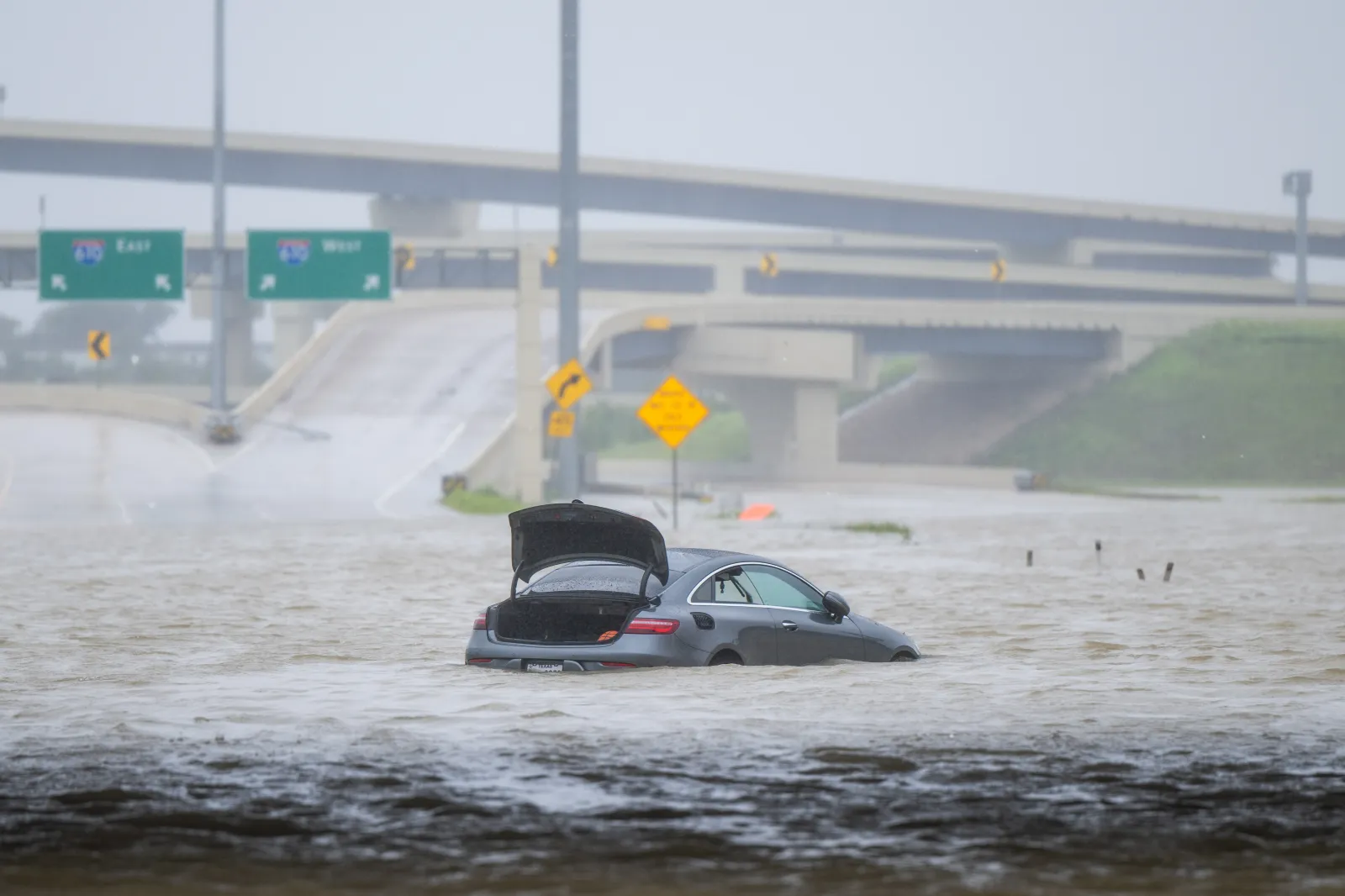
Southeast Texas could see up to two months’ worth of rain in just days as a slow-moving system may stall over the region beginning Wednesday.
Meteorologists warn that the prolonged storm could bring widespread flooding, especially in Houston and nearby flood-prone areas.
The system is being fueled by a strengthening Super El Niño pattern, raising concern that this could be an early preview of a wetter season ahead.
Read More on Weather
Here’s how much rain could fall—and who’s most at risk.
Texas Flash Flood Warning: What We Know
Multiple flash flood warnings were issued Tuesday afternoon across north and west-central Texas as thunderstorms brought heavy rain and rapidly worsening conditions. In the Dallas-Fort Worth metro area, warnings covering Dallas, Tarrant, Collin and Denton Counties were set to remain in effect until around 6 p.m., with radar and rain gauges indicating 1 to 2 inches of rainfall already and additional totals of up to 2 inches possible. Forecasters warned that flash flooding was already occurring or could begin shortly, particularly in urban areas, highways, streets and low-lying spots where drainage is poor.
Farther west, additional warnings in parts of Tom Green, Concho and Runnels Counties described a more severe, life-threatening picture, with 1 to 4 inches of rain already fallen in some areas and more expected. These alerts warned of “considerable” flash flood damage threats, including dangerous flooding of creeks, low-water crossings and rural roads near communities like Rowena, Vancourt and Wall. Officials cautioned that floodwaters could rise quickly and that unstable banks and culverts could pose additional risks, urging people to move to higher ground and avoid flooded areas.
How Much Rain Could Fall in Texas?
- 8-12 inches in Port Arthur and surrounding areas
- Up to a foot possible in parts of Southeast Texas
- Enough to exceed May + June averages combined in some areas
Why Houston Could Be Hit Hardest
- The greater metropolitan area is home to more than 7 million people.
- Already above May average (5.18 vs. 5.01)
- June average ~6 inches
When the Rain Starts—and How Long It Lasts
- Begins Wednesday
- Continues through May 28
The rain is expected to begin in East Texas on Wednesday and will persist through next Thursday as the system stalls and produces "relentless rain," a video shared by WFLA-TV chief meteorologist Jeff Berardelli said.
"Drought to Deluge! Developing El Niño gives us an early preview of the pattern for late fall and winter. A strong Subtropical Jetstream will hover near Texas, Louisiana and the lower MS Valley through the next 1-2 weeks," Berardelli posted on X on Tuesday. "Rainfall may total a foot plus in spots in the next 10 days with more possible after that. Medium range models can underestimate the rainfall. This jet is powered by a record warm Eastern Pacific, associated with the developing El Niño."
Where Flooding Risk Is Highest
If the system develops as projected, parts of East and Southeast Texas could be hit hardest, with impacts potentially extending into neighboring Louisiana. Flash flooding could pose the most immediate threat, especially in urban areas and locations with poor drainage.
-
Southeast Texas (including Houston): highest totals, prolonged rain
- More than 322,000 homes in the Houston area are within floodplains, Understanding Houston reported, making them particularly vulnerable.
-
Texas–Louisiana border (Port Arthur): 8–12 inches
-
Western Louisiana: up to 8 inches, locally higher
Meteorologists at the National Weather Service in Lake Charles said the heaviest rain is expected to fall from Southeast Texas into central Louisiana, but warned that even areas expecting lower totals could still see flash flooding.
Why This Type of Rain Is More Dangerous
- Rain lasts for days, not hours
- Soil becomes saturated, equating to more runoff
- Rivers can keep rising even after the rain stops
Lake Conroe is already about 97 percent full, and Lake Houston is at capacity, meaning additional rainfall could quickly increase downstream flooding risk.
What’s Driving the Storm System
- 82 percent chance El Niño develops (May–July)
- Strong subtropical jet bringing moisture into TX/LA
- 96 percent chance it continues into winter
Looking further ahead, Berardelli said the rainy weather could then shift further east into Florida.
"But it's too early to know," he said in the post. "This active subtropical jet pattern is a preview of the stormy El Niño setup late fall into winter for the Southeast."
What to Watch Next
- Rainfall totals are likely to shift over the coming days
- Flood watches could be issued as the system develops
- Storm may expand east toward Florida afterward
- Officials urge residents to monitor local alerts
...
View 0 Comments
Submit Correction
View Editorial & AI Guidelines