...

By Sam Stevenson
Associate News Editor
0
Share
Newsweek is a Trust Project member
See more of our trusted coverage when you search.Prefer Newsweek on Googleto see more of our trusted coverage when you search.
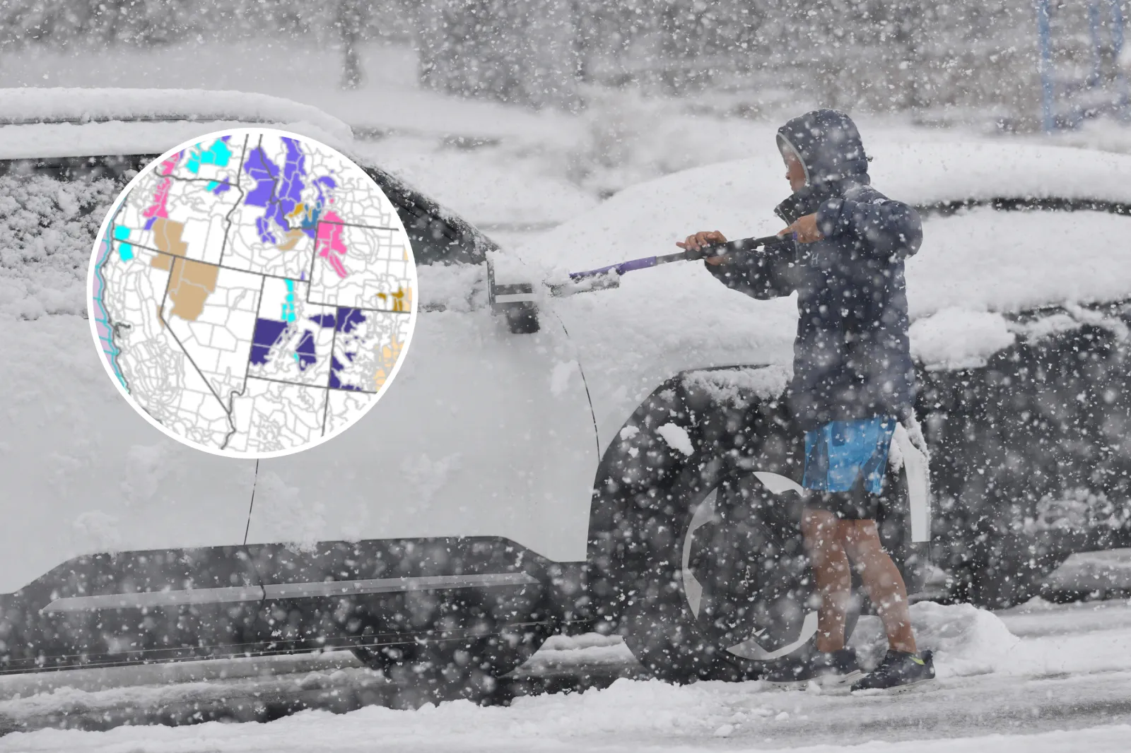
A late‑season winter storm is set to slam parts of the western U.S. with heavy mountain snow, fierce winds and hazardous travel conditions through midweek, with forecasters warning that rapidly building snowpack could trigger "avalanche danger."
The National Weather Service (NWS) has issued multiple winter storm warnings across the northern Rockies and Pacific Northwest, with snowfall totals forecast to reach 1 to 2 feet in the most exposed mountain ranges.
Montana, Oregon, Washington, Idaho and Alaska are forecast to be impacted by the bad weather.
Read More on Weather
Blowing snow, near‑whiteout conditions and dangerous backcountry travel are expected as the system intensifies.
Here is how the storm is expected to unfold, starting with the areas facing the most severe impacts.
...
Absaroka, Beartooth and Crazy Mountains
The most dangerous conditions are forecast across southern Montana’s high terrain, where the NWS in Billings issued winter storm warnings at 11:11 p.m. MDT Tuesday.
The warnings cover the Absaroka/Beartooth Mountains and the Crazy Mountains, and remain in effect from noon Wednesday until 6 a.m. MDT Friday.
Forecasters expect 1 to 2 feet of snow, with the highest totals above 9,000 feet.
Winds could gust as high as 55 mph, creating widespread blowing and drifting snow and sharply reduced visibility.
In its warning, the National Weather Service cautioned that backcountry and high‑country recreation could become extremely dangerous, noting that "avalanche danger may increase" as heavy snowfall piles up on existing snowpack.
Travel in exposed mountain areas is expected to be treacherous, with rapidly changing conditions and limited visibility through Thursday night.
Northern and Central Oregon Cascades
Across Oregon and southern Washington, a powerful burst of mountain snow is set to blanket the Cascades.
The NWS in Portland issued a winter storm warning at 12:46 p.m. PDT Tuesday, covering the North Oregon Cascades, Cascades of Marion, Linn and Lane Counties, and the South Washington Cascades.
The warning runs from 5 p.m. Tuesday until 5 a.m. PDT Thursday above 2,500 feet.
Snow totals of 12 to 22 inches are forecast, with the heaviest accumulations expected between Marion and Lane counties.
Winds could gust up to 45 mph, increasing the risk of blowing snow and slick, hazardous roads, particularly at higher passes such as Santiam and Willamette.
Officials warned that backcountry travel is not advised, and drivers should be prepared for dangerous mountain driving conditions through early Thursday.
The NWS says: "Consider postponing travel until weather conditions improve.
"If you must travel, be sure to slow down and allow extra time.
"If your car becomes trapped in deep snow, be sure to keep your car off to stay safe from potential carbon monoxide poisoning.
"Be aware that walking surfaces may be slick. Walk with extra care."
East Slopes of the Oregon Cascades
Another winter storm warning remains in effect along the East Slopes of the Oregon Cascades, following an update issued by the NWS in Pendleton at 10:41 p.m. PDT Tuesday.
The warning covers elevations above 4,000 feet and lasts until 5 a.m. PDT Thursday.
Forecasters predict 6 to 12 inches of snow, with locally higher totals along the Cascade crest.
Winds may gust as high as 45 mph, bringing down branches and lowering visibility during periods of heavier snowfall.
Snowfall is expected to remain steady late Tuesday through Wednesday morning before tapering into snow showers later Wednesday.
Washington Cascades
In Washington state, a broad winter storm warning issued at 9:55 p.m. PDT Tuesday by the NWS in Seattle remains active until 11 p.m. PDT Wednesday.
The warning covers large portions of the Washington Cascades, including Snoqualmie Pass, Stevens Pass, Mount Rainier, Mount Baker and White Pass.
Snow accumulations of 8 to 18 inches are forecast above 2,500 feet, with the heaviest snowfall expected overnight into Wednesday morning.
Wind gusts could reach 40 mph, adding to difficult travel and the potential for localized power outages.
Officials warned that travel could become very difficult, especially during peak commute hours.
Central Washington and Chelan County Mountains
Elsewhere in Washington, the NWS in Spokane issued a winter storm warning at 11:08 a.m. PDT Tuesday for Western Chelan County, including Holden Village, Stehekin and Stevens Pass.
That warning remains in effect until 5 a.m. PDT Wednesday.
Forecasters expect 8 to 14 inches of snow above 4,000 feet, with lighter accumulations at lower elevations.
Winds may gust up to 35 mph, creating winter driving conditions across key mountain passes.
"Drive with caution and be prepared for sudden changes in visibility," the NWS says.
"Leave plenty of room between you and the motorist ahead of you, and allow extra time to reach your destination.
"Avoid sudden braking or acceleration, and be especially cautious on hills or when making turns. Make sure your car is winterized and in good working order."
Glacier National Park and Northern Montana
Much of northern Montana is under winter weather advisories, with conditions edging toward warning‑level impacts in higher terrain.
The East Glacier Park Region remains under an advisory issued at 11:11 p.m. MDT Tuesday, running until noon MDT Thursday.
Snow totals of 12 to 20 inches above 6,000 feet are expected, with 4 to 10 inches possible at lower elevations.
Wind gusts over 50 mph could significantly reduce visibility and make travel through Glacier National Park and nearby passes extremely difficult.
Similar advisories are in effect through Thursday morning for the Big Belt, Little Belt, Castle and Bridger Mountains, where 2 to 6 inches of snow is expected alongside gusty winds.
Idaho and Western Montana
In Idaho and western Montana, multiple winter weather advisories are in effect through Thursday morning, covering mountain ranges from the Sawtooth and Stanley Basin to the Bitterroot and Clearwater Mountains.
Snow accumulations generally range from 6 to 18 inches at higher elevations, with lighter totals in valleys.
The NWS has warned of an elevated risk for snow squalls, briefly reducing visibility and making driving conditions hazardous during the Wednesday evening and Thursday morning commutes.
Arctic and Alaska Coasts
Farther north, the Western Arctic Coast of Alaska remains under a winter weather advisory from 7 p.m. Tuesday through 4 p.m. AKDT Thursday.
While snowfall amounts are limited, winds gusting to 45 mph could produce blowing snow and sharply reduced visibility, making travel difficult, particularly in open areas between Point Lay and Point Hope.
View 0 Comments
Submit Correction
View Editorial & AI Guidelines