...

By Anna Skinner
Associate News Editor
0
Share
Newsweek is a Trust Project member
See more of our trusted coverage when you search.Prefer Newsweek on Googleto see more of our trusted coverage when you search.
Early weather forecasts from AccuWeather imply that some holiday travelers and last-minute shoppers could have rain or snow to contend with during Christmas week.
The forecasts come after tumultuous Thanksgiving travel for many people in the Northeast, particularly those on their way home from family gatherings on Black Friday as heavy lake-effect snow hit Ohio, Pennsylvania and New York. The storm was strong enough to prompt some officials to urge people to delay travel home as snowplows would have a difficult time keeping roads clear during heavier bouts of snow.
With just under two weeks to go until Christmas, the forecasts could still change. However, as of this week, AccuWeather meteorologists are anticipating that rain, snow and winter storms could hit much of the United States during Christmas week.
Read More on U.S.
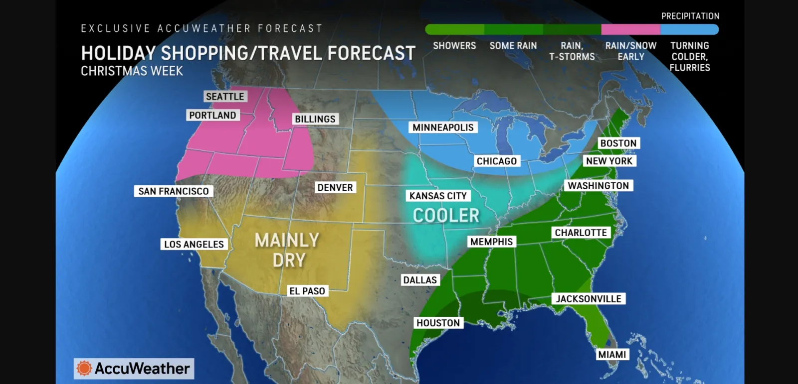
A colder pattern will take hold in the Northeast and Midwest during Christmas week, AccuWeather reported, along with the chance of a winter storm.
According to a map included in the forecast, the chance at rain could extend from Maine through eastern Texas, with the greatest chance of thunderstorms possible in far eastern Texas, southern Louisiana, southern Alabama, southern Mississippi and the far western panhandle of Florida.
The Northwest could have rain and snow to contend with, the map showed, though the Southwest and much of the central U.S. are expecting "mainly dry" weather, AccuWeather reported.
...
AccuWeather long-range expert Paul Pastelok told Newsweek that much of the Christmas week forecast depends on a system looking to form in the east next Thursday and into Friday.
"If it's a big system, and if it's just one system, it could bring a lot of cold all the way down to the Gulf Coast that will have a hard time getting out of the picture the start of Christmas week," he said. "If it's a weaker system, there could be some snow and rain for holiday shopping late next week, but the cold doesn't look as prevalent."
When it comes to temperature and precipitation trends, an outlook from the National Weather Service (NWS) Climate Prediction Center shows above-average temperatures for the western half of the U.S., with a chance at below-average temperatures in the Southeast. Meanwhile, the Climate Prediction Center anticipates below-average precipitation amounts—be it from rain or snow—across nearly the entire U.S., with the Northeast expecting to be "near normal," whereas western Washington and northwestern Oregon, as well as far south Texas, could be above-normal.
The outlook is valid from December 20 to December 26.
Pastelok said that meteorologists will have a better idea at Christmas weather by late next week, adding that holiday traveling will likely begin on Friday or Saturday before Christmas.
View 0 Comments
Submit Correction
View Editorial & AI Guidelines