...

By Giulia Carbonaro
Senior Reporter
0
Share
Newsweek is a Trust Project member
See more of our trusted coverage when you search.Prefer Newsweek on Googleto see more of our trusted coverage when you search.
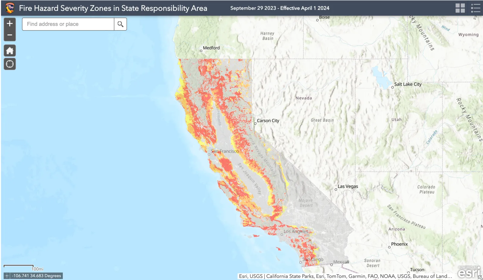
The California Department of Forestry and Fire Protection, Cal Fire, released new draft maps this week showing fire hazards in cities across California's Bay Area and the state's northern coast as part of a two-month rollout process ending in Southern California on March 24.
The new maps, which provide crucial information on the risk of wildfires breaking out across California and update previous documents dating back to 2011, are likely to directly impact building and landscape-use guidelines in some of the state's most vulnerable areas.
Why It Matters
California Governor Gavin Newsom said Cal Fire's new maps would add at least 1.4 million acres to zones requiring stricter fire safety regulations. More than 360,000 of those acres are in the coastal Northern California area, according to the Los Angeles Times.
Read More
California Gets Warning About Water Supply3 min read

Winter Weather Warnings in 4 States As 24 Inches of Snow To Hit3 min read

Gavin Newsom Cracks Down on Homelessness in California4 min read

According to the Democratic governor, the maps will expand the current wildfire building resiliency requirements in the state's high-fire hazard zones by 1.16 million acres, while the zones at "very high" risk of fires are expected to expand by approximately 247,000 new acres.
This, in turn, could have the positive effect of lowering insurance premiums for homeowners in high-hazard communities, should companies be responsive to the new fire-resilient measures introduced by residents. However, the California Department of Insurance said that the maps are unlikely to change how insurers weigh risk and decide on premiums.
What To Know
Cal Fire released the new draft maps only weeks after devastating fires ravaged Los Angeles County for over a week in January, burning down thousands of structures, including homes, and destroying entire neighborhoods. While the release seems timely, the California legislature had asked the agency to produce new maps more than three years ago.
The new draft maps released Monday include Oakland, Santa Rosa and Northern California's wine country. All these areas have been affected by devastating fires in recent decades: the Tunnel fire of 1991 killed 25 people in Oakland and injured 150 more; the 2017 Tubbs fire in Santa Rosa, which was the most destructive in California history at the time, killed 22; and the Kincade fire of 2019 in Sonoma County burned through over 77,000 acres of land for 13 days before it was controlled, injuring four.
...

...

...
Cal Fire's Fire Hazard Severity Zones (FHSZ) are divided into three categories: "moderate," "high," and "very high." To calculate the fire risk in California, officials consider factors such as fire history, existing and potential fuel (like natural vegetation), predicted flame length, blowing embers, terrain and typical fire weather.
Oakland saw the largest decline in acres for the areas considered at "very high" and "high risk" of fires, down to 1,945 and 2,598, respectively. This is a steep drop compared to 2011 when more than 10,000 acres were designated at "very high" risk.
Thirteen other cities out of the 109 mapped in the coastal Northern California region also saw a decrease in acreage for the highest-risk fire zones.
Zones at "high" and "very high" risk increased by nearly 20,000 acres in San Jose, and in Cupertino, they expanded from 16 acres to almost 1,600. Sonoma County also saw its two highest-hazard zones increase from 11 acres to more than 16,700. The county's zones at "very high" fire hazard now cover nearly 7,600 acres, compared to just 11 acres in 2011.
The maps, as specified by Cal Fire, only indicate the risk of fires breaking out in these areas but do not estimate losses and damage these could cause. They also do not consider mitigation measures such as home hardening or fuel reduction efforts.

...
What People Are Saying
California Governor Gavin Newsom, in a statement: "We are living in a new reality of extremes. Believe the science – and your own damn eyes: Mother Nature is changing the way we live and we must continue adapting to those changes. California's resilience means we will keep updating our standards in the most fire-prone areas."
California Fire Marshal Daniel Berlant told the San Francisco Chronicle: "We as Californians have to shift our minds as to how we landscape and how we design our homes."
What Happens Next
Cities and counties included in the draft maps released on February 24 have 30 days to make the new zones public and 120 days to request adjustment, officially adopt the maps, and apply stricter fire safety regulations.
Homes in the zone identified in the new draft maps as having a "very high fire severity hazard" must adhere to the Golden State's strictest fire regulations, including California's pending ban on plants and other combustible materials within five feet of homes.
Homeowners in zones at "high" or "moderate" risk must follow stricter codes when building or renovating homes, favoring flame-resistant material. Cal Fire has more details on hardening your home to withstand wildfires and create a defensible space around your property.
Cal Fire will release a third batch of maps covering a large swath of central California on March 10, while a final batch covering Southern California will be issued on March 24.
View 0 Comments
Submit Correction
View Editorial & AI Guidelines