...

By Hollie Silverman
News Editor
0
Share
Newsweek is a Trust Project member
See more of our trusted coverage when you search.Prefer Newsweek on Googleto see more of our trusted coverage when you search.
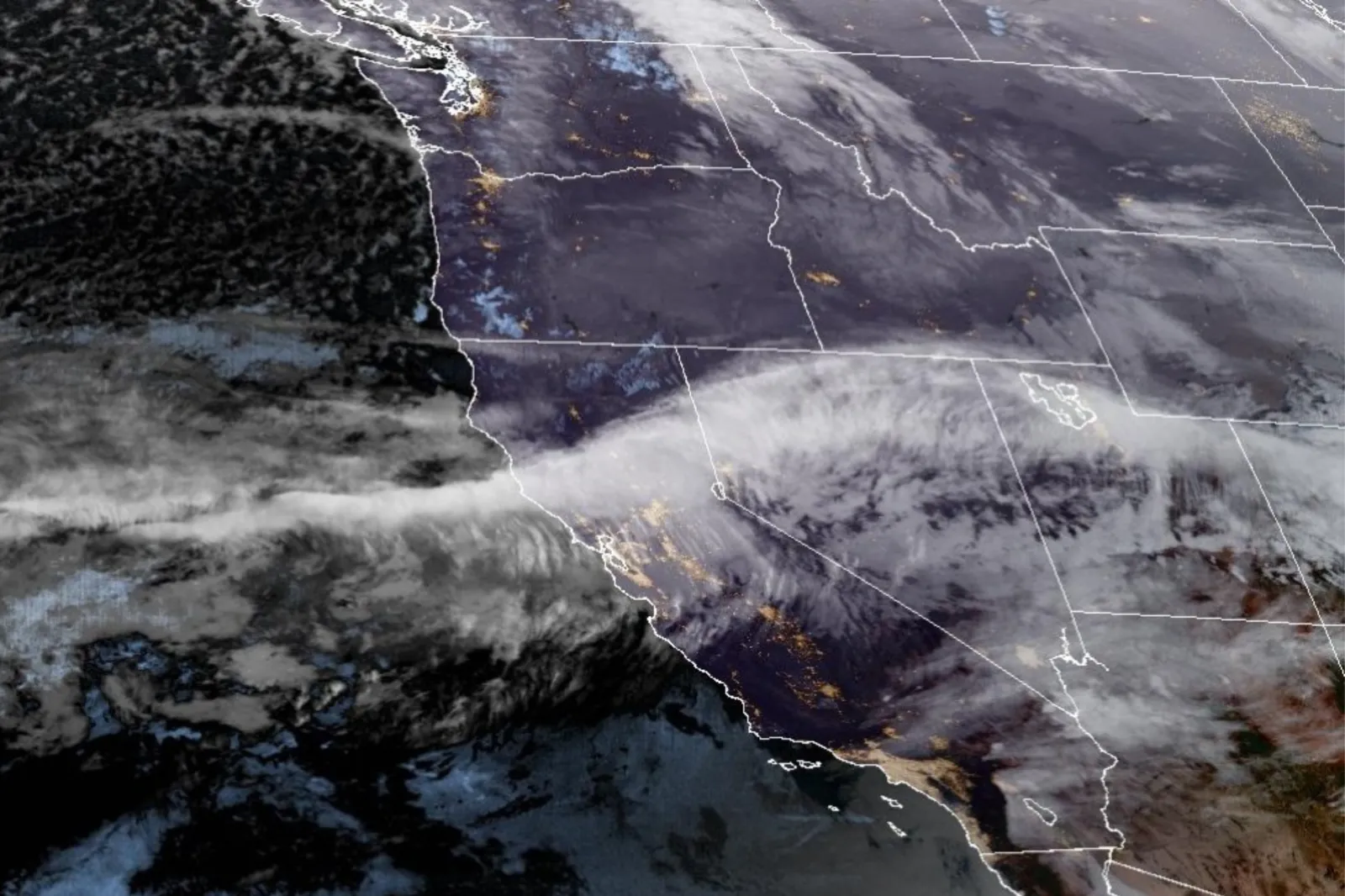
An atmospheric river is forecast to hit California early next week, bringing heavy rainfall as well as potential flooding and landslides, with the National Weather Service (NWS) issuing flood watches for several areas just a week after Washington state saw record rainfall from a similar system.
The timing of these storms also overlaps with holiday travel, amplifying concerns about road safety and potential delays for millions of people.
What Is an Atmospheric River?
An atmospheric river is a long, narrow corridor of concentrated moisture in the atmosphere, acting like a “moisture highway” that transports large amounts of water vapor from the tropics toward the West Coast.
Read More on Weather
When these rivers of moisture make landfall, they can produce intense, prolonged rainfall. Atmospheric rivers are a regular feature of West Coast weather and are responsible for a significant portion of California's annual rainfall.
...
Atmospheric River Forecast for California
The core of a potent atmospheric river aimed at the Bay Area was expected to bring the region’s wettest weekend since last November, with San Francisco projected to receive 1 to 3 inches of rain by Sunday night, according to the San Francisco Chronicle.
Rainfall was forecast to arrive in several rounds from Friday through Monday, with heavier downpours possible late Sunday into Monday. Rain totals depend on the atmospheric river’s exact trajectory.
The NWS issued flood watches for Northern California and parts of the Central Valley, with the main concern being urban and street flooding in low-lying areas. As soils become saturated, risk also rises for creek and stream flooding, minor river flooding, and localized mudslides.
While regulated rivers such as the Sacramento and Feather are expected to remain within their banks due to ample storage capacity, coastal and foothill rivers could see swift rises as the rain persisted, according to local news outlet KCRA.
Forecasts also highlighted the threat of landslides, especially on hillsides and burn scars left from recent wildfires.
"Recently burned areas may face an elevated risk of flash flooding and debris flows. Power outages are possible in some areas due to high winds and heavy precipitation," the Climate Prediction Center stated in a recent advisory.
Washington’s Experience With Atmospheric Rivers
Over the last few weeks, Washington state has endured record flooding and fierce windstorms due to multiple atmospheric river systems.
Parts of western Washington saw up to 18 inches of rain in a week, resulting in levee breaches and downed trees from gusts as high as 81 miles per hour in Pullman and 75 mph in Spokane.
The Pacific Northwest has continued to receive additional rain, prolonging flooding and heightening landslide risks as saturated soils persist.
What People Are Saying
Greg Porter, senior newsroom meteorologist at the San Francisco Chronicle, wrote on Saturday: “By Sunday night into Monday, the impacts could begin to compound, especially if the atmospheric river stays focused on the Bay Area…Periods of moderate to heavy rain rotating in from the ocean during this timeframe could start to lead to localized creek and urban flooding, especially in poor drainage areas. Rivers are not expected to flood, but smaller waterways could respond more quickly.
An advisory from the NWS: “Possible impacts during the busy holiday travel period include flooding, landslides, and challenging travel conditions across mountain passes. Recently burned areas may face an elevated risk of flash flooding and debris flows. Power outages are possible in some areas due to high winds and heavy precipitation.”
Heather Waldman, meteorologist at local news station KCRA, said in a forecast: “There is an increased chance for minor creek and stream flooding as heavy rain returns Tuesday night into Thursday. If you live near a creek and you've experienced minor flooding before, take steps to get your property ready over the next few days."
What Happens Next
The NWS Flood Watch for Northern California remains in effect through December 26, with the next strong storm likely to bring greater wind and precipitation statewide on Christmas Eve.
View 0 Comments
Submit Correction
View Editorial & AI Guidelines