
By Joe Edwards
Reporter
0
Share
Newsweek is a Trust Project member
See more of our trusted coverage when you search.Prefer Newsweek on Googleto see more of our trusted coverage when you search.
Forecast maps show states facing another round of snow later this week as frigid Arctic air is expected to hit the U.S. Northeast.
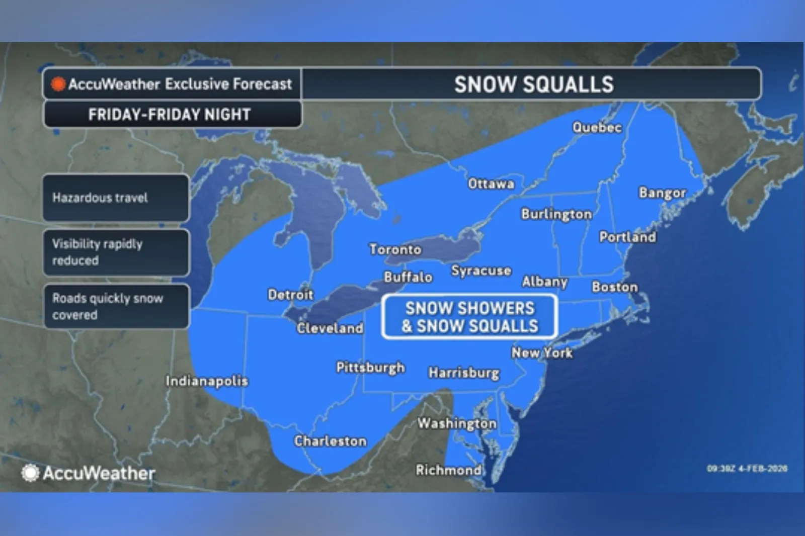
An Arctic front will push from the Great Lakes into the Northeast from Friday into Saturday, setting off snow squalls, powerful wind gusts and a swift drop back into hazardous cold, according to AccuWeather experts.
In a media advisory shared with Newsweek on Wednesday, AccuWeather meteorologists cautioned that the fast‑shifting weather could hamper travel, stress infrastructure, and increase energy demand in major population and business hubs.
Read More on News
The Arctic front is projected to sweep across the Great Lakes and Ohio Valley on Friday, then advance into the Northeast and New England by Saturday. Snow showers and squalls are likely along its path, with some areas seeing snowfall persist into Saturday, the outlet said.
...
Peyton Simmers, an AccuWeather meteorologist, warned that Friday’s squalls could quickly cut visibility and leave roads coated with snow and ice.
AccuWeather said effects are anticipated from the Great Lakes and Ohio Valley into portions of New England, with the Friday evening commute especially vulnerable due to the quick‑changing conditions along major interstates and roads.
It reported that winds may gust between 30 and 40 mph on Friday from the Great Lakes into the Ohio Valley, strengthening to roughly 50–55 mph in parts of the Northeast and New England by Saturday.

...
A wide swath of the U.S. was recently hit by an expansive winter storm—dubbed Winter Storm Fern by The Weather Channel—which brought widespread snow and ice impacts from Texas to Maine.
The Weather Prediction Center (WPC) warned Wednesday that the outbreak would bring “extreme cold and dangerous wind chills,” with the coldest chills in the minus 30s expected across the Interior Northeast and New England.
“Very cold daytime temperatures will struggle to rise above the teens and single digits,” it added.
Fox Weather also reported that strong northwest winds will drive frigid polar‑vortex air into the heavily populated Boston, New York and Philadelphia metro areas.
What Is The Polar Vortex?
According to the National Weather Service (NWS), the polar vortex is a large area of low pressure and frigid air surrounding each of Earth’s poles.
The word 'vortex' refers to the counterclockwise circulation that helps confine this cold air near the poles. In many northern hemisphere winters, the polar vortex can stretch southward, allowing cold air to spill down with the jet stream.
This is a fairly common winter pattern and is often linked to major Arctic cold outbreaks in the U.S., the agency said.
View 0 Comments
Submit Correction
View Editorial & AI Guidelines