
...

By Tom Howarth
Science Reporter (Nature)
0
Share
Newsweek is a Trust Project member
See more of our trusted coverage when you search.Prefer Newsweek on Googleto see more of our trusted coverage when you search.
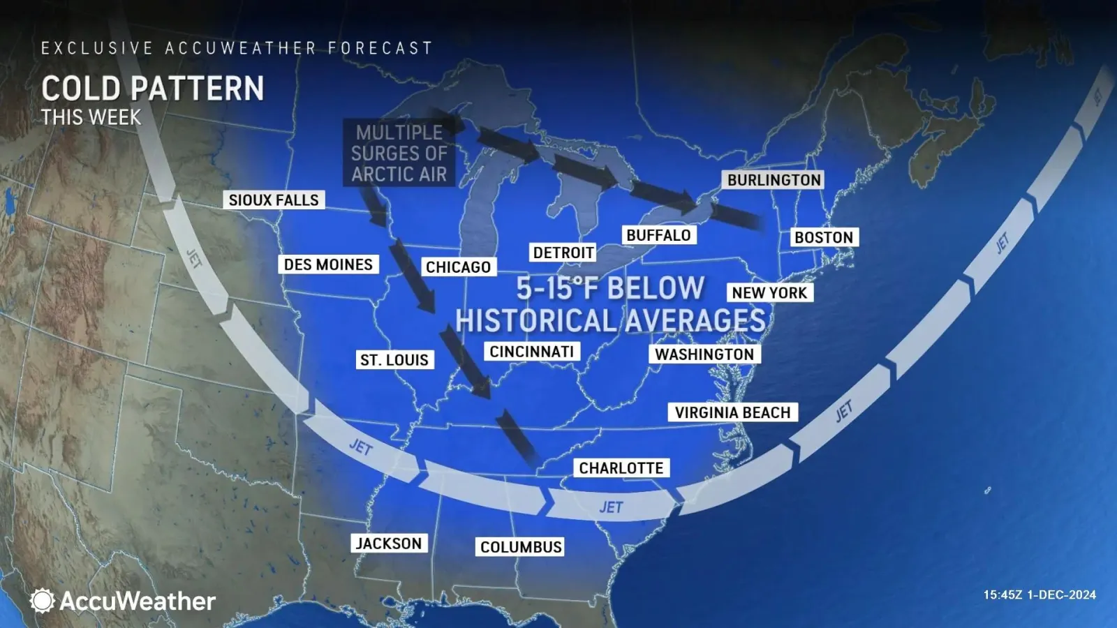
As if Thanksgiving wasn't chilly enough, the coldest air of the season so far is forecast to spread across the Northeast and beyond this week.
As temperatures plunge nationwide, more rounds of snow are expected in regions that have already seen snowfall over the holiday weekend.
"This is going to be a cold week for millions of people across the Northeast. There will even be a glancing blow of colder air across parts of the Southeast and the Carolinas," Bernie Rayno, AccuWeather chief on-air meteorologist, said in an advisory sent to the media on Monday.
Read More on U.S.
"This is a direct discharge of Arctic air. We're concerned about the potential for travel problems Wednesday night and Thursday morning," Rayno added.
...
How Could the Snowy Conditions Affect Travel?
Snow showers and squalls, gusty winds and slippery roads will make driving hazardous in parts of the interior Northeast, the Great Lakes region and the Appalachians, especially on Wednesday night.
Snow squalls—sudden whiteout conditions—are of particular concern. They can produce icy road conditions in a matter of minutes, according to the National Weather Service (NWS), and crop up even when no large-scale winter storm is in progress.
"Snow squalls can reduce visibility within a matter of seconds," Jon Porter, AccuWeather chief meteorologist, said in the advisory.
"A rapid temperature drop could lead to a layer of ice that is quickly coated by snow. People who are traveling through Syracuse, Buffalo, Erie, Cleveland, Detroit and Pittsburgh need to be prepared."
If you do need to travel through the worst of the weather, be prepared.
"Take it easy; have an emergency kit with you in the car. When it is snowing, there is no need to drive over the speed or even at speed and stay off your phones while driving in these conditions," AccuWeather senior meteorologist Tyler Roys told Newsweek.
How Much Snow Can We Expect?
Thankfully, snow accumulation is expected to be lower than last week, though road closures near the Great Lakes are still likely. As temperatures drop, the snow already on the ground becomes dryer and more powdery, which helps it blow and drift more readily.
...
"A full-fledged blizzard could occur in areas downwind of the Great Lakes, including parts of the Buffalo and Cleveland metro areas, with snow falling at rates of 2 inches or more per hour," Porter said.
"Complete whiteouts are possible with winds gusting to 50 mph or even higher. Lake-effect snow bands can also be narrow, sometimes only 3 to 5 miles wide, where the intense snow is focused[ …] Within any of these heavy snow bands, should a traveler become stranded, the situation can quickly escalate to a life-threatening emergency."
For residents in the Northeast, this could be the coldest start to December in over a decade.
But the Arctic blast won't limit itself to just this corner of the country. Temperatures in Atlanta, Charlotte, Birmingham, Alabama, and Columbia, South Carolina, could drop into the 20s degrees Fahrenheit on Thursday night.
Pipes could burst in poorly insulated homes and businesses in the Southeast, and gardens not used to the cold could be damaged as the Arctic air sweeps in.
Do you have a tip on a science story that Newsweek should be covering? Do you have a question about cold weather? Let us know via science@newsweek.com.
Update 12/3/24, 1:31 p.m. ET: This article was updated with comment from Tyler Roys.
View 0 Comments
Submit Correction
View Editorial & AI Guidelines